The Pamir Plateau in Kashgar

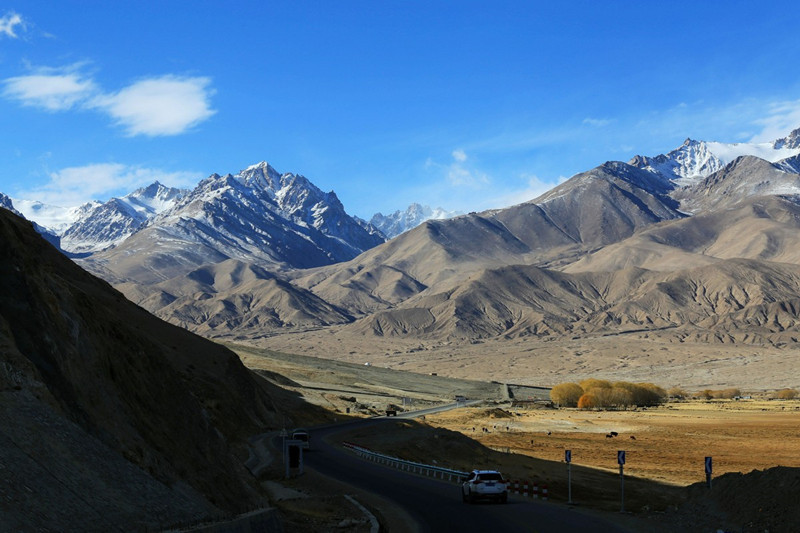
The Pamir Plateau (帕米尔高原), often referred to as the “Roof of the World” in ancient Persian, is located in Central Asia, at the southeastern edge of China. The plateau spans across Tajikistan, China, and Afghanistan. It lies at the convergence of several major mountain ranges, including the Kunlun Mountains (昆仑山), Karakoram Mountains (喀喇昆仑山), Hindu Kush Mountains (兴都库什山), and Tian Shan Mountains (天山). The plateau covers an area of approximately 100,000 square kilometers.
Geographic Features
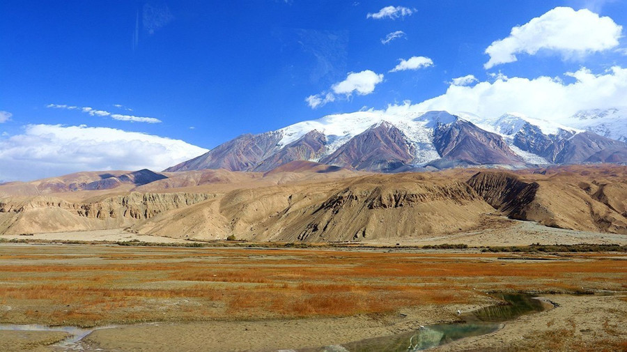
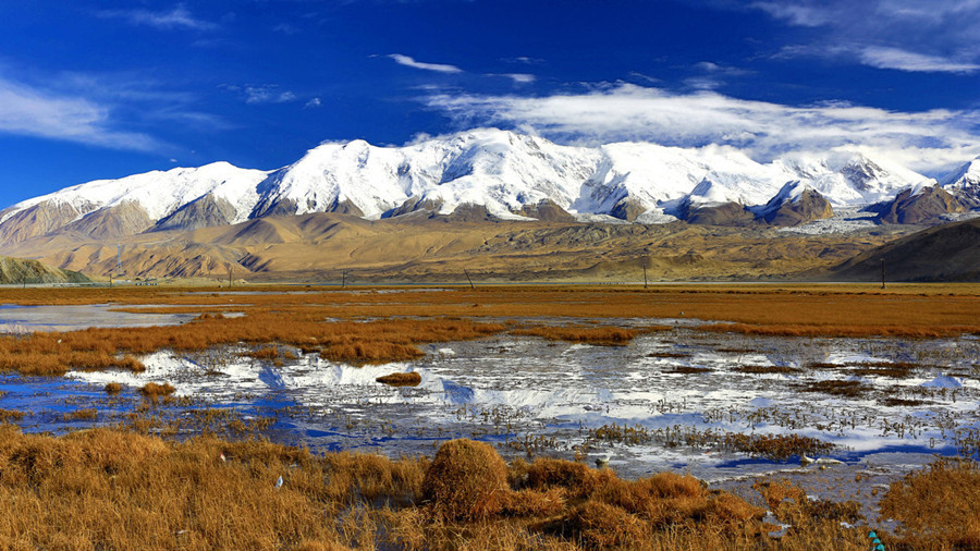
The Pamir Plateau is characterized by its towering mountains, with an average elevation of over 4500 meters. The main peaks rise above 6000 meters, and the highest peaks in Tajikistan include Communism Peak (共产主义峰) at 7495 meters and Lenin Peak (列宁峰) at 7134 meters. The plateau’s terrain is notably complex, with interwoven east-west and north-south mountain ranges, resulting in deep gorges and extensive river networks.
The eastern part of the Pamir Plateau is distinguished by lower elevations and wide valleys. The area is dotted with numerous glaciers, with 1085 glaciers covering an area of 8041 square kilometers. The longest glacier, Fedchenko Glacier (费德钦科冰川), stretches 77 kilometers in length. The largest glacial lake is Karakul Lake (喀拉湖), which spans an area of 383 square kilometers and reaches a depth of 236 meters.
In China, the Pamir Plateau is located in the Kizilsu Kirghiz Autonomous Prefecture (克孜勒苏柯尔克孜自治州) and Kashgar Region (喀什地区). It lies between the Tashkurgan Valley (塔什库尔干谷地) and Mujigou Valley (木吉谷地) to the east and the Western Kunlun Mountains (西昆仑山) to the south, with the Karakoram Mountains (喀喇昆仑山) to the north. The region is historically significant, serving as a major passage along the Silk Road (丝绸之路) and a key route for ancient travelers heading toward India, Afghanistan, and Iran.
History and Formation
The geological history of the Pamir Plateau dates back approximately 400 to 500 million years to the Ordovician period. Over this immense period, the area has experienced various cycles of tectonic uplift and subsidence, with periods of oceanic flooding and land emergence. Around 280 million years ago (during the Early Permian period), the region was part of a vast ocean, known as the Tethys Sea (特提斯海), which connected to seas in North Africa, Southern Europe, Western Asia, and Southeast Asia. This warm climate facilitated the flourishing of marine life.
In the Mesozoic era (approximately 240 million years ago), tectonic plate movements caused the Indian Plate (印度板块) to shift northward. This movement led to the formation of the Kunlun Mountains (昆仑山) and the Karakoram Range (喀喇昆仑山), as the Indian plate continued to push northward, forcing the Tethys Sea region to become landmass. By 80 million years ago, the northern Tibetan Plateau and parts of the Himalayas had emerged from the sea.
The Himalayan orogeny (喜马拉雅运动), occurring around 10 million years ago, resulted in the rapid uplift of the Tibetan Plateau. This process continues today, with the central Tibetan region being mainly eroded, while the edges of the plateau are still rising.
In recent history, the Pamir Plateau has seen continued tectonic uplift, with the region experiencing the rise of the Tibetan Plateau and Kunlun Mountains, contributing to its modern form. Over the last 10,000 years, the Pamir Plateau has risen at a rate of 7 cm per year, making it one of the highest regions on Earth.
Significance and Unique Features
The Pamir Plateau is a crucial area for studying the geological evolution of the Earth, and it has been essential to the history of Central Asia. Its high altitude, glaciers, lakes, and complex mountain ranges make it a unique destination for adventure travelers and geologists alike.
Climate
The Pamir Plateau has a continental dry climate (大陆性干旱气候), with stark seasonal differences. Summers are mild, and winters are cold. The plateau’s average temperature is around 11.7°C, with temperatures reaching as high as 13.1°C and as low as -10.5°C. Rainfall is minimal, with an average annual precipitation of 61.5 mm.
Cultural and Historical Importance
The Pamir Plateau has long been a critical part of the Silk Road (丝绸之路), facilitating trade and cultural exchange between China, Central Asia, and beyond. As the gateway to Xinjiang (新疆) and Tajikistan, it has played a central role in the movement of people and goods, including the spread of Buddhism (佛教) and other cultural influences.
Throughout its history, the plateau has been inhabited by various nomadic tribes and has been a critical location for military and commercial routes, particularly through passes like Khunjerab Pass (红其拉甫) and Mingteige Pass (明铁盖). The Karakoram Highway (中巴公路), which connects China and Pakistan, also passes through the Pamir Plateau, providing access to this remote yet vital area.
Today, the Pamir Plateau remains a unique and rugged part of the world, offering stunning landscapes and an unparalleled sense of adventure for travelers seeking to explore the “Roof of the World”.
Geological Features
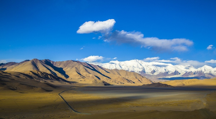
The Pamir Plateau (帕米尔高原) is not a flat plateau but rather a complex region consisting of several mountain ranges, wide valleys, and basins between these mountains. It is divided into two parts by the Academy Mountains (科学院山) in the northwest of Sarez Lake (萨雷兹湖), with a north-south orientation. The eastern part of the plateau is relatively flat, with two major northwest-southeast mountain ranges and several river valleys and lakes. The elevation of the eastern Pamir Plateau is between 5000-6000 meters with a relative height difference of 1000-1500 meters. The mountains are rounded, and they are separated by wide, shallow river valleys. At altitudes of 4000-5000 meters, there are glacial plains and desert plains.
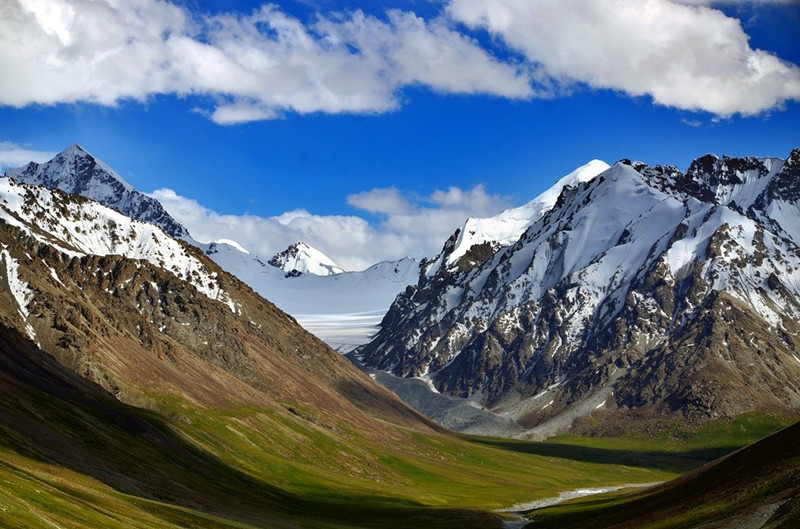
In contrast, the western Pamir Plateau is characterized by several parallel northeast-southwest mountain ranges and deep valleys. This region has a higher relative altitude, with a dramatic landscape of towering mountains and deep valleys. The mountains in the western Pamir rise 2000-3500 meters above the valleys. The valleys are narrow and deep, and mountain ridges rise as much as 3000-4000 meters above the valley floors, with alpine glaciers and snowfields. This region also features an extensive range of glacial terrain.
Geographical Subdivisions
The Pamir Plateau is divided into eight regions, referred to as the “Eight Pas” (八“帕”). These regions are significant in local history, and the Qing Dynasty (清朝) commemorated them by erecting monuments at various points in the region. The Pamir Plateau is inhabited and traditionally used by the Tajik (塔吉克族) and Kyrgyz (柯尔克孜族) people. The eight regions, from north to south, are:
-
Heshkuzhuk Pamir (和什库珠克帕米尔)
-
Sarez Pamir (萨雷兹帕米尔)
-
Langkuri Pamir (郎库里帕米尔)
-
Archur Pamir (阿尔楚尔帕米尔)
-
Great Pamir (大帕米尔)
-
Small Pamir (小帕米尔)
-
Taktunbash Pamir (塔克敦巴什帕米尔)
-
Wakhan Pamir (瓦罕帕米尔)
Climate Characteristics
The Pamir Plateau is known for its harsh, cold, and strongly continental high-altitude climate. The eastern Pamir Plateau experiences a particularly harsh continental climate. Winters are long (from October to April), with temperatures averaging -17.8°C at 3600 meters in January and dropping to as low as -50°C in some places, such as Brungol (布仑戈尔). In summer, the average temperature is around 13.9°C, with a maximum of about 20°C. The eastern Pamir experiences very little precipitation, with annual rainfall ranging from 75 to 100 millimeters, and in places like the Karakul Basin (喀拉湖盆地), it is even lower, only about 30 millimeters.
The western Pamir Plateau, with its northeast-southwest mountain ranges and deep valleys, has considerable vertical climatic variation. Moist air from the Atlantic (大西洋) rises along the mountain slopes, cooling and condensing into fog, with significant rainfall. The windward slopes can receive up to 1000 millimeters of rainfall annually, while the valleys below only receive between 100 and 200 millimeters. At 2100 meters, the average temperature in January is -7.4°C, and in July, it rises to 22.5°C.
Hydrology and Glacial Activity
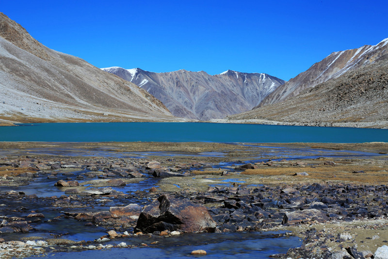
The Pamir Plateau is a major center for modern glacial activity, with over 1000 glaciers covering an area of nearly 10,000 square kilometers. The Fedchenko Glacier (费德钦科冰川), located in the Academy Mountains (科学院山脉), is one of the largest mountain glaciers in the world, stretching 77 kilometers and covering 907 square kilometers. The snow line in the western Pamir is at an altitude of 4000-4400 meters, while in the eastern part, it rises to 5000-5500 meters.
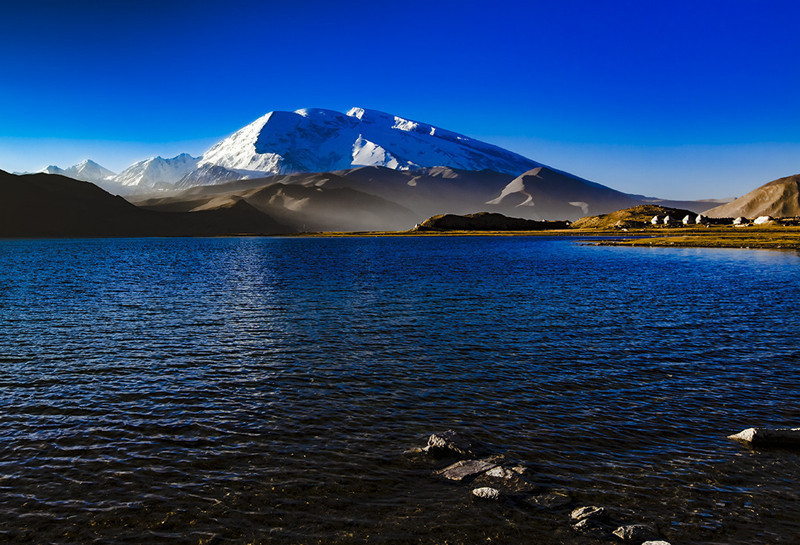
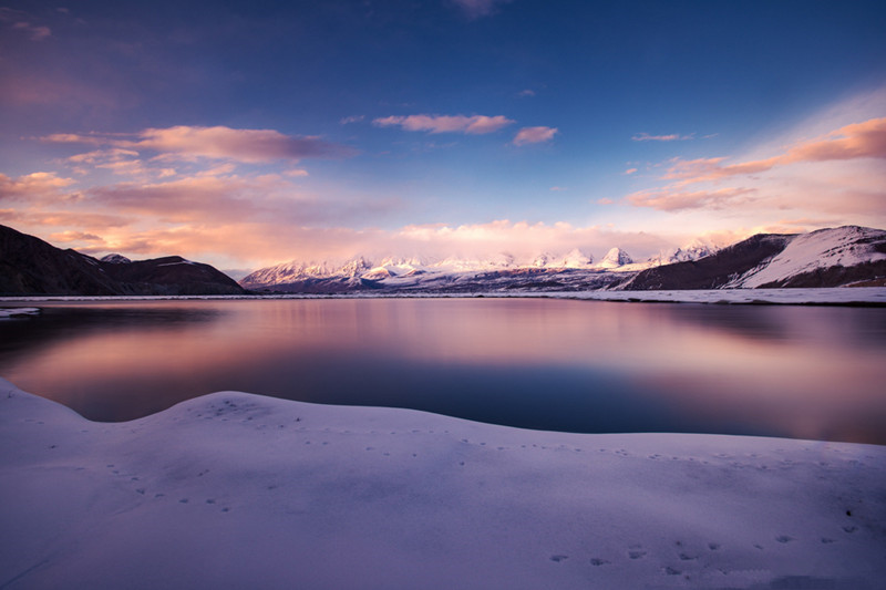
These glaciers feed into the surrounding river systems, providing water to the Tarim Basin (塔里木盆地). The Karakul Lake (喀拉湖), located in the northern part of the Pamir Plateau, is one of the highest lakes in the world, with an elevation of 3954 meters. It is a saltwater lake and plays a crucial role in the regional hydrology.
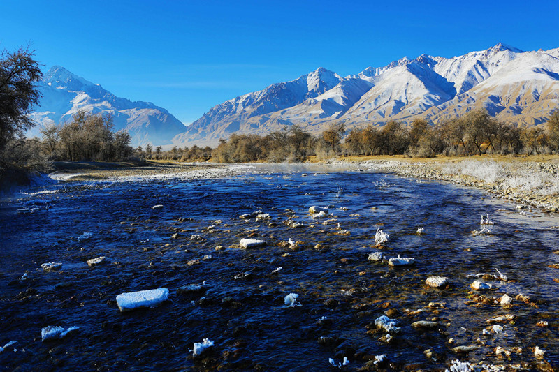
The rivers of the Pamir Plateau, such as the Wakhan River (瓦罕河) and the Panj River (喷赤河), converge to form the Amu Darya (阿姆河), which continues to irrigate other areas downstream. However, the region also experiences occasional disruptions in the river systems due to earthquakes, such as the Sarez Lake (萨雷斯湖), which was formed by a massive landslide blocking a river channel.
Significance in the Silk Road
The Pamir Plateau was one of the most challenging and mysterious parts of the ancient Silk Road (丝绸之路). Due to its high altitude and harsh climate, it was a critical route for merchants and travelers in antiquity. The plateau provided the passage between Central Asia and South Asia, and it became a key link in the trade network that spanned across China, India, and Persia.
Several relay stations or caravanserais (驿站) were established along the plateau, offering shelter and supplies to travelers along the route. In Akto County (阿克陶县), there are remains of stone caravanserais, with three-room stone buildings in Brungkou (布伦口). Along the ancient route from Tashkurgan (塔什库尔干) to the Mingteige Mountain Pass (明铁盖山口), six caravanserai ruins have been found, with one, Dabudar (达布达尔), particularly well-preserved. The ruins include stone ovens and clear signs of use, such as smoke marks on the walls.
Today, the Pamir Plateau remains a stunning and rugged landscape, offering a unique experience for adventurous travelers who wish to explore one of the most remote and challenging regions on earth.
Natural Resources
Flora
The natural landscape of the Pamir Plateau (帕米尔高原) exhibits vertical zonation differences and east-west variations. These differences are primarily due to the vertical elevation of the plateau, the east-west topographical variations, and the significant reduction in precipitation from west to east. The plateau’s base is a desert zone, mainly composed of barren rocky desert and glacial debris.
The Western Pamir Plateau (西帕米尔) has more abundant vegetation compared to the Eastern Pamir Plateau (东帕米尔) due to its higher relative altitude and greater precipitation. The vertical natural zonation is also prominent. In the lower plateau and valley areas, desert communities of artemisia (蒿类) and saltwood (盐木) dominate. Between 3200-3600 meters, spiny cushion plants, such as spiny lespedeza (多刺紫云英), are common. Between 3600-3800 meters, the prickly grass (棱狐茅) and needlegrass (针茅) dominate the alpine meadows. Between 3800-4300 meters, alpine cold desert plants are found. Above this, in the permanent snow zone, willows, poplars, birches, and rose shrubs form the shrublands in the Western Pamir valleys. In areas with irrigation, grapes, apples, and apricot trees are also cultivated.
On the Eastern Pamir, the landscape mainly features alpine cold deserts, with no tree vegetation. Low shrubs from the genus Ephedra (优若属), spiny snowberry (刺雪属), and spiny legumes (棘豆属) are found in dry slopes and valleys, while artemisia grows in more humid valley bottoms.
Fauna
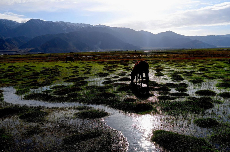
The Eastern Pamir is a key breeding ground for goats and argali sheep. Occasionally, blue sheep and East Asian argali are also found. In less human-influenced areas, mountain goats are common, while noble goats are found in the lower mountain ridges between the Panj River (喷赤河) and Wakhan River (瓦罕河). Brown bears feed on marmots, and wolves also prey on them. The strict protection against hunting wild sheep and mountain goats has allowed the snow leopard to thrive. The bearded vulture (髯鹫) and the Himalayan griffon vulture (喜马拉雅秃鹫) frequently visit the highest peaks, while snow partridges, pheasants, and ptarmigans can be seen in the western mountain areas. A large number of migratory waterfowl that travel between Siberia and South Asia also visit the Eastern Pamir.
Cultural and Historical Significance
Historical Records
Historical records indicate that the Pamir Plateau (帕米尔高原), known as Congling (葱岭) in ancient China, was once a crucial region for the Kashgar (喀什) nomads. In the Qing Dynasty (清朝), the region was mostly under Chinese control, though it was later divided among China, Russia, and Afghanistan. The Pamir Plateau became an important border area during the struggle between the British and Russian empires, with both countries vying for influence over the region as they expanded their territories in Central Asia.
In the Qing Dynasty, the Pamir Plateau was referred to as Congling (葱岭), due to the lush wild onions and cliffside vegetation in the region. The Pamir Plateau was also known as Buzhou Mountain (不周山) in ancient Chinese texts, such as the Shan Hai Jing (山海经), where it was described as a place where the Heavenly Pillar (天柱) was broken by the clash between Gong Gong and Zhuan Xu, resulting in the tilting of the Earth. This mythological interpretation associated the Pamir Plateau with the Kunlun Mountains (昆仑山), which is often considered the “backbone” of ancient Chinese geography.
Early Chinese and Western Accounts
During the Han Dynasty, as China’s influence expanded, merchants traveling along the Silk Road (丝绸之路) had to pass through the Pamir Plateau, which was already known as Congling (葱岭). The Tang Dynasty (唐朝) saw the Pamir Plateau referred to as “Bomi Luo Chuan” (波谜罗川) in Xuanzang’s (玄奘) travelogue, The Great Tang Records on the Western Regions (大唐西域记), where it was described as a narrow, remote region surrounded by snow-capped mountains.
Marco Polo’s Account
In his famous Travel Diaries, Marco Polo (马可·波罗) described the Pamir Plateau as an incredibly high and desolate region, where travelers would struggle due to the extreme cold and lack of vegetation. Polo noted the Pamir Plateau as a challenging yet beautiful plateau with waterfowl and wild sheep. The high altitude and severe climate made it difficult for travelers to find food or light a fire, adding to the mystique of this remote region.
Historical Evolution
The Pamir Plateau was known by many names in historical texts, such as Buzhou Mountain (不周山) in ancient Chinese records. The region’s mythological significance is also seen in the descriptions by famous poets like Qu Yuan (屈原) in his work Li Sao (离骚) and Han Dynasty (西汉) texts. The name Pamir (帕米尔) eventually became the widely recognized term for the region, which was also used by Marco Polo in his Travel Diaries.
By the Qing Dynasty, the Pamir Plateau had fully replaced previous names and was divided into eight distinct regions, including Heshkuzhuk Pamir (和什库珠克帕米尔) and Sarez Pamir (萨雷兹帕米尔), as noted by the Qing Dynasty maps.
Modern Times
In the Qing Dynasty, the Pamir Plateau was fully governed by China, but following the Russian Empire‘s aggressive expansion and the British Empire‘s interests in Tibet (西藏), a border agreement between China, Russia, and Britain divided the region. The Wakhan Pamir (瓦罕帕米尔) was controlled by Britain, while Russia took the northern section of the plateau.
In the 20th century, the Pamir Plateau remained under dispute until the People’s Republic of China and Afghanistan officially established borders in 1960. The Pamir Plateau‘s current borders were finalized between China and Tajikistan (塔吉克斯坦) in the late 1990s, ensuring that all territorial disputes were resolved. Today, the Pamir Plateau remains an important geographical landmark and is recognized as one of the most rugged and remote regions in the world.
Human Geography
Ethnic Groups
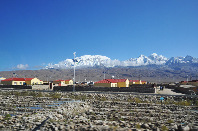
The Pamir Plateau (帕米尔高原) has a population of about 98,000 people, mainly consisting of the Kyrgyz (柯尔克孜族) and Tajik (塔吉克族) ethnic groups. The Tajiks live in the western part of the plateau, speaking an Iranian language and following Shia Islam. The Kyrgyz people reside mainly in the eastern part, speaking a Turkic language and practicing Sunni Islam. The locals are primarily engaged in agriculture and animal husbandry, with small hydropower plants and mining operations.
Located in southern Xinjiang, the Tashkurgan Tajik Autonomous County (塔什库尔干塔吉克自治县) is situated about 300-400 kilometers from Kashgar (喀什).
Economy
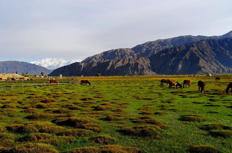
In the high-altitude areas of the Eastern Pamir Plateau (东帕米尔), livestock farming mainly involves yak and various hybrid breeds, as well as sheep and goats. Barley, potatoes, beans, rape seeds, and root vegetables are the main crops in this region. In the Western Pamir Valleys (西帕米尔), the government has encouraged the cultivation of cotton and other crops.
Large orchards, mainly growing apples, pears, apricots, and grapes, are spread across many valleys and hills in the western part of the plateau, with elevations between 1,524–1,981 meters (5,000–6,500 feet). Wheat is the primary grain crop, and corn is the main feed for winter livestock. In these valleys, cattle are increasingly replacing sheep and goats as the main livestock.
Transportation
Before the establishment of modern road links, the Pamir Plateau was an essential route for communication between the east and the west. The ancient Silk Road (丝绸之路), after entering the Tarim Basin (塔里木盆地), split into two routes—north and south—extending toward different destinations. The routes met at the Congling Mountains (葱岭) and then led west to the famous Stone City (石头城). From there, the routes split again toward Central Asia, South Asia, the northern and western parts of the Indian Subcontinent, and Europe. This strategic location made Tashkurgan (塔什库尔干) the terminus of the eastern route and the starting point of the western route.
Due to its position as a Silk Road fortress, Tashkurgan has seen numerous envoys, generals, kings, artisans, scholars, monks, and merchants over the past three thousand years. These individuals left their mark through political struggles, military alliances, economic exchanges, cultural collisions and fusion, and scientific progress, leaving behind rich historical legacies and inspiring poetry.
Tourist Information
Tourism Resources
The Southern and Central Routes of the ancient Silk Road passed through the Pamir Plateau, connecting the plateau with Western Asia, South Asia, and Europe. The Tajik (塔吉克族) and Kyrgyz (柯尔克孜族) people, who have lived in the plateau for generations, are known for their hardworking, brave, simple, and hospitable nature, as well as their rich and colorful customs.
Tashkurgan Tajik Autonomous County is located in the northeastern part of the Pamir Plateau and borders Pakistan, Afghanistan, and Tajikistan. The total length of the border is 888.8 kilometers. The name “Tashkurgan” means “crown” or “the one who wears a crown” in the Tajik language. The area is rich in natural resources, with unique landscapes and diverse climatic ecosystems.
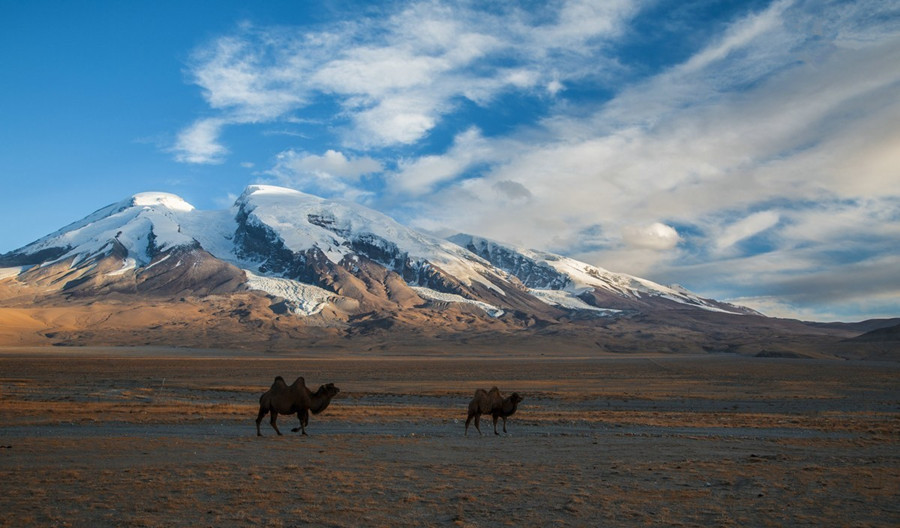
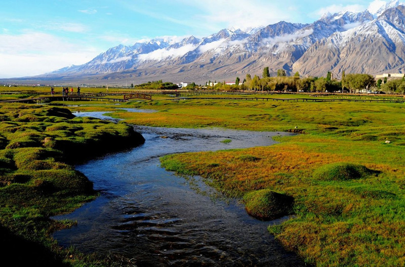
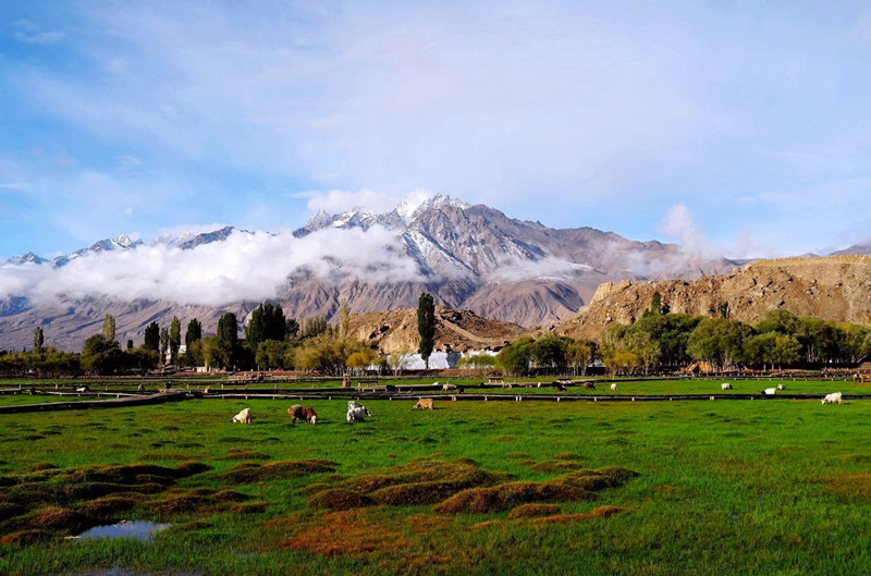
The Mustagh Ata Peak (慕士塔格峰), at 7,509 meters (24,636 feet), stands majestically in the region, covered with snow year-round, earning it the title “Father of Ice Mountains.” The base of the mountain is dotted with strange rocks, unique flowers, fountains, hot springs, lakes, and pastures. Ancient cultural relics, such as the Stone City and the Princess Fortress, are scattered across the valleys beneath the towering ice peaks. Visiting Tashkurgan offers the opportunity to enjoy multiple sunrises and sunsets each day, hear the beautiful legends of the Tajik people, and experience their unique customs.
Attractions
-
Tashkurgan Town (塔什库尔干镇): With a population of 26,600, mainly Tajiks, the town is a small but orderly settlement. It features asphalt roads lined with poplar trees and decorated with cement sculptures (resembling Tajik figures). Due to an increase in tourism in the 21st century, new hotels, restaurants, and entertainment venues, such as dance halls, have been established. The locals are friendly and hospitable.
-
Wedding Season: November is the wedding season for the Tajik people. During this time, we visited a family in Taiman Township (塔合曼乡), where they warmly welcomed us with sweets and candies. The Tajik women and children, dressed in vibrant clothes similar to Russian attire, including long boots, red skirts, and high-topped floral hats, invite visitors to take pictures. They dance joyfully, creating opportunities for beautiful photographs.
-
Stone City (石头城): Located to the north of Tashkurgan, Stone City sits at an altitude of 3,100 meters and is one of the most famous ancient ruins along the Silk Road in Xinjiang. In the Han Dynasty, it was the capital of Puli Kingdom (蒲犁国), and large-scale construction began around the Kepantuo period. During the Tang Dynasty, after the government unified the western regions, a Congling Garrison was set up here. In the early Yuan Dynasty, the city was expanded, and the Stone City was renovated. In 1902, the Qing Dynasty established a local administrative office in the city, repairing and adding to the fortifications. The city has yielded relics such as Tang Dynasty coins and official documents. In 1954, it became the capital of Tajik Autonomous County.
Travel Tips
-
Border Pass: To visit the Pamir Plateau, a border pass is required. Tourists traveling in groups can obtain the pass through their tour operator. Individuals can apply at the Kashgar Public Security Bureau (喀什市公安局). The office does not process requests on weekends. Foreign travelers can enter Pakistan through the Hongqila Pass (红其拉甫山口) with valid travel documents.
-
Altitude and Weather: The region has a cold climate, with temperatures dropping quickly, especially at altitudes over 5,000 meters. It is advised to bring an oxygen bag to cope with the thin air.
-
Travel Season: The best time to visit is from May to September.


