
Design Inspiration
Designer: Luo Xiaoteng (罗晓腾)
The designer, Luo Xiaoteng, was originally disappointed after failing the national college entrance exam, which prevented him from entering his desired design department. Despite this setback, he remained committed to his passion and pursued a career in design. He described his work as being designed from a Hong Kong local’s perspective. The “V” shape in the design represents Victoria Harbour (维多利亚港), symbolizing both the waves of the sea and the feeling of being in the harbor, allowing visitors to relax and experience the scenic beauty.
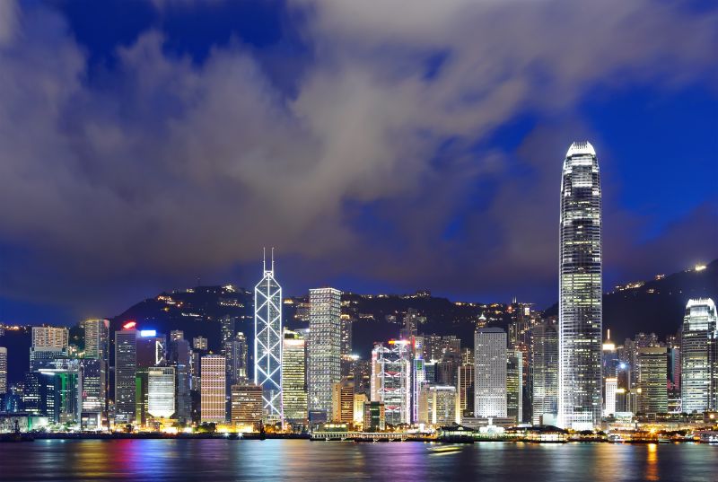
Victoria Harbour as One of China’s Most Beautiful Coastal Areas
On October 23, 2005, the rankings for China’s Most Beautiful Places were announced in Beijing. The event, organized by China National Geography (中国国家地理), involved 34 media outlets. The rankings were divided into three categories: expert committees, media voting, and online/mobile user votes. Victoria Harbour‘s coastline was ranked as one of the Top 8 Most Beautiful Coastal Areas in China.
Poem by Qiu Fucan (丘福灿):
“初心风雨路征程,使命百载正前行。”
This poem celebrates the enduring spirit of Hong Kong’s Victoria Harbour, which is the birthplace of the Guangdong-Hong Kong-Macau Greater Bay Area and an important window for China’s openness to the world.
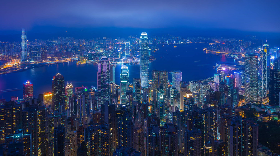
Geographical Location
According to data from 2004, Victoria Harbour covers an area of 41.88 square kilometers with an average water depth of 12 meters. The deepest navigable channel, Lei Yue Mun (鲤鱼门), reaches a depth of about 43 meters, while the shallowest, near Yau Ma Tei (油麻地), is about 7 meters deep. The harbour stretches from Lei Yue Mun (鲤鱼门) in the east to Tsing Chau (青洲), Tsing Yi Island (青衣岛), South Bay (南湾角) of Ting Kau (汀九), with the western boundary called the West Anchorage Bay (西锚湾). The tidal range in Victoria Harbour is around 1 meter. The harbour also includes several islands such as Tsing Yi Island (青衣岛), Tsing Chau (青洲), Little Tsing Chau (小青洲), and Kowloon Stone (九龙石), as well as channels like Lam Pak (蓝巴勒海峡), Sulphur Channel (硫磺海峡), and Lei Yue Mun (鲤鱼门).
Natural Harbour Formation
Victoria Harbour is a natural deep-water harbour. It was formed when the sea level was lower than it is today. Originally, it was a valley between Victoria Peak (太平山) and Kowloon. Over time, as the sea level rose, the valley became submerged, forming the current harbor. The water level in Victoria Harbour reached a record high of 3.96 meters during Typhoon Wanda in 1962. Between 1954 and 2004, the water level rose by 12 cm, averaging 2.3 mm annually. From 1987 to 1999, the rate of rise was much faster, at 22 mm per year, which is ten times the global average rate. However, after 1999, the water level began to decline rapidly.
In the past, Victoria Harbour was much wider. Before urban development, both shores were natural coastlines. In the 1930s, the area around North Point (北角) was still a beach. As late as the 1970s, people still swam near the pier in Shau Kei Wan (筲箕湾). However, rapid urbanization led to pollution and reclamation, which caused the harbor to become choppier and more turbulent.
Historical Significance
Historically, Victoria Harbour was an important waterway for trade, particularly during the Song Dynasty (宋朝), when troops were stationed to protect salt merchants and the maritime salt trade. However, Hong Kong was a small fishing village with only 5,000 people before 1840, and records of the early days of Victoria Harbour are scarce. According to historical texts, the harbor was already a key military location in ancient times.
In the Qing Dynasty (清朝), the British recognized the harbor’s potential as an East Asian port, and they eventually seized it during the Opium Wars to develop their Far Eastern maritime trade. This marked the beginning of Hong Kong’s transformation into a British colony.
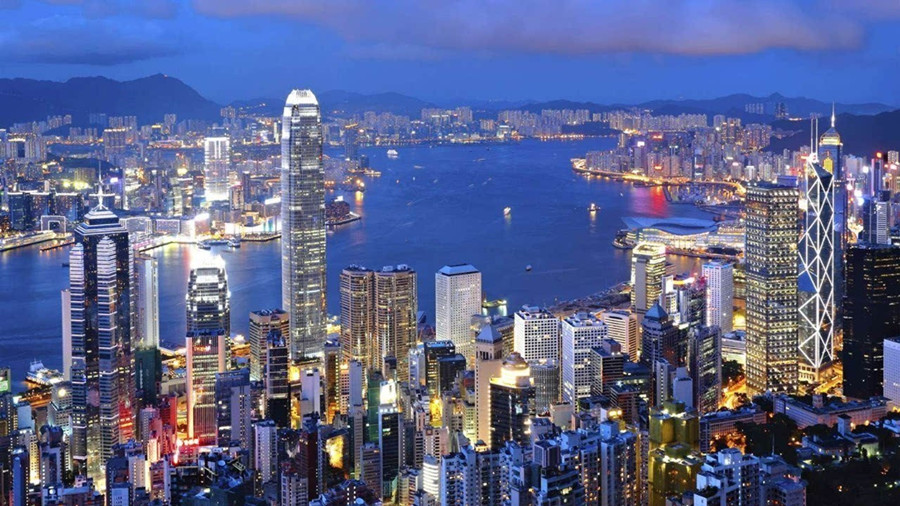
Naming of Victoria Harbour
Victoria Harbour is named after Queen Victoria (维多利亚女王), who ruled for 64 years (1837–1901) during the height of the British Empire’s power. During her reign, Britain was a prosperous “Empire on which the sun never set.”
In 1840, just three years after her accession to the throne, the British launched the First Opium War (鸦片战争) against China, forcing the Qing Government to sign the Treaty of Nanjing (中英《南京条约》), which ceded Hong Kong to Britain. In 1860, following the Second Opium War, Britain signed the Treaty of Beijing (《北京条约》) with China and occupied Kowloon Peninsula (九龙半岛). In 1861, the harbor between Hong Kong Island (香港岛) and Kowloon Peninsula (九龙半岛) was named Victoria Harbour to honor the queen.
After Britain took control of Victoria Harbour, they gradually developed beautiful buildings and streets along the South Shore of Hong Kong Island (香港岛). The waterfront became so attractive that some Western encyclopedias mistakenly referred to the land area along the harbor as the “capital” of Hong Kong until the 1970s.
In the 1900 edition of the Encyclopaedia Britannica, Victoria Harbour was described as follows:
“Hong Kong, or Victoria Harbour, often gives a lively impression, with up to 240 salutes fired in a day. The capital, Victoria, has a population of over 166,000, of which 6,000 are Europeans or Americans. Opium remains a significant part of the town’s economy, as Hong Kong has no manufacturing industries.”
The British presence brought Western culture, science, technology, and economic prosperity to Hong Kong. Today, Victoria Harbour is no longer the opium trade hub it once was, thanks to China’s “One Country, Two Systems” policy, and Hong Kong’s return to China in 1997. Since then, the city has flourished and remains a global financial and cultural hub.


One thought on “Victoria Harbour in Hong Kong”