


Lhasa River
The Lhasa River (拉萨河), known as Ji Qu (吉曲) in Tibetan, meaning “Happy River” or “River of Joy,” is located in the central and southern part of Tibet. It originates from the northern slopes of the Nyenchen Tanglha Mountains (念青唐古拉山脉) at Luoburula (罗布如拉), flowing through Mozhugongka County (墨竹工卡县), Dazi District (达孜区), and eventually entering the Yarlung Tsangpo River (雅鲁藏布江) at Qushui County (曲水县) in Lhasa (拉萨).
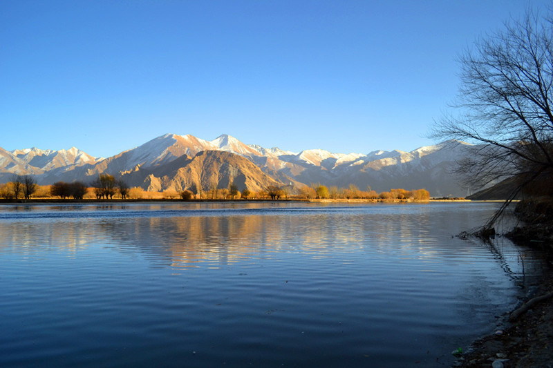
The river follows a massive “S” shape, stretching from the northeast to the southwest. With a length of 568 kilometers (公里) and a watershed area of 31,760 square kilometers (平方公里), it is one of the five major tributaries of the Yarlung Tsangpo River (雅鲁藏布江), and is regarded as one of the highest rivers in the world, with elevations ranging from 3,600 to 5,500 meters (米).
Significance
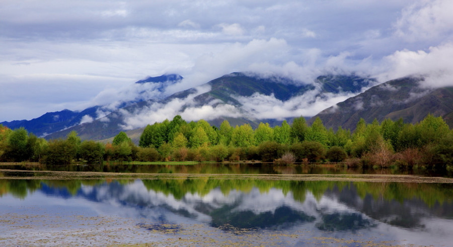
The Lhasa River is crucial for the development of the Lhasa Valley (拉萨河谷), the political, economic, cultural, transportation, and religious center of Tibet. It flows through an area known for its rich biodiversity, abundant geothermal resources, and is one of the primary grain-producing areas in Tibet.
Geographic Location
-
Source: The river originates from Luoburula (罗布如拉), located on the southern slopes of the Nyenchen Tanglha Mountains (念青唐古拉山脉) in Nyalam County (嘉黎县).
-
Flow Direction: It flows through Mozhugongka County (墨竹工卡县) and Dazi District (达孜区), and eventually merges with the Yarlung Tsangpo River (雅鲁藏布江) near Qushui County (曲水县) in Lhasa (拉萨).
-
Length: 568 kilometers (公里)
-
Watershed Area: 31,760 square kilometers (平方公里)
-
Average Elevation: The river begins at an elevation of 5,200 meters (米) and ends at 3,580 meters (米).
Hydrology and Geography
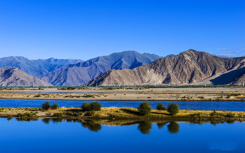
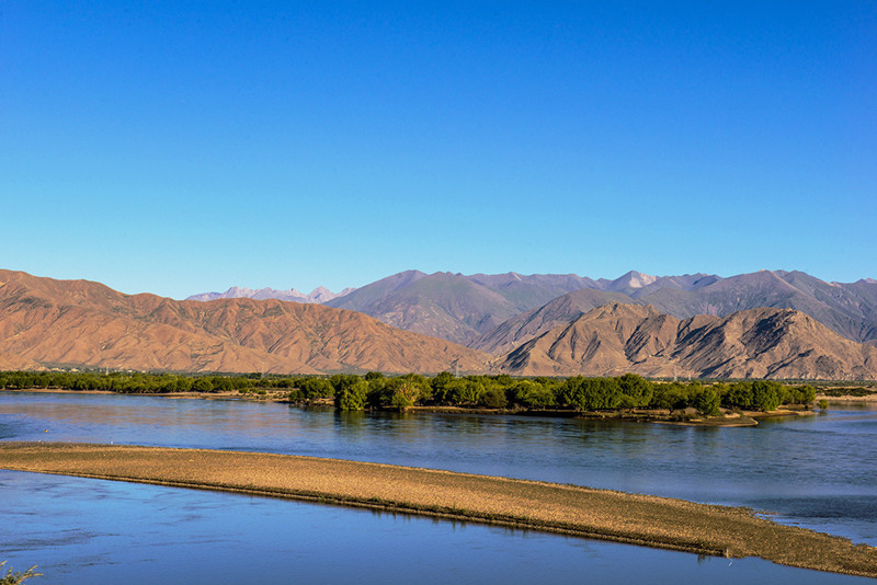
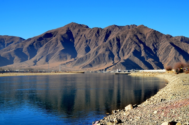
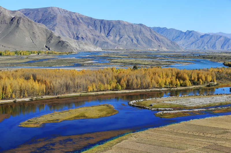
The Lhasa River’s flow basin is characterized by steep, high-altitude mountains and fertile valleys. Its total elevation drop is approximately 1,620 meters (落差1620米), and the mountains on either side of the river range between 4,000 and 5,500 meters (海拔5000~5500米). The river’s watershed spans across 5,000 to 5,500 meters (米) peaks in the northern regions and 4,000 to 4,500 meters (米) in the southern regions.
Climate Characteristics
The region’s climate is cold and dry, with annual rainfall averaging 400-500 mm (毫米). Most of the rainfall occurs in the summer months (May to September), while winters are dry with minimal snow. The area is prone to storms, particularly during late winter and spring. The average temperature in January is 0°C (零摄氏度), and in July it rises to 17°C (摄氏度). Extreme temperatures range from -14°C (最低温度) to 31°C (最高温度).
Flora and Fauna
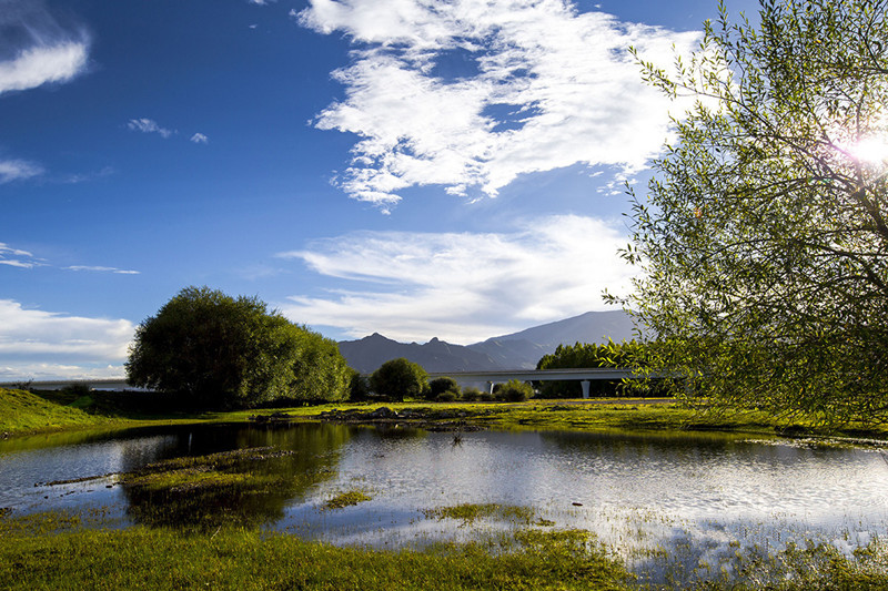
The Lhasa River and its surrounding wetlands are home to a variety of wildlife, particularly bird species. The wet grasslands (湿草甸) along the river are an important wintering ground for the black-necked cranes (黑颈鹤). These wetlands, especially those in Linzhou (林周) and Mozhugongka, are vital for migratory birds, providing them with a resting and feeding area.
Notable Bird Sightings
-
During the 1985/1986 winter, around 140 black-necked cranes (黑颈鹤) were observed in the region.
-
In March 1986, 108 black-necked cranes (黑颈鹤) and 110 bar-headed geese (斑头雁) were spotted, alongside 350 ducks (鸭) of various species including red-breasted mergansers (赤麻鸭), green-winged teals (绿翅鸭), and mallards (绿头鸭).
-
Winter counts in 1987 showed 187 black-necked cranes, 380 bar-headed geese, and 254 red-breasted mergansers (赤麻鸭), among other species.
Social and Cultural Importance
The Lhasa River is often referred to as the “mother river” (母亲河) of Lhasa (拉萨). In 633 AD (公元633年), after Songtsen Gampo (松赞干布), the Tibetan king, unified the Tibetan tribes, he moved the capital to the Lhasa River Valley, setting the stage for Lhasa’s transformation into the cultural and political heart of Tibet.
Over time, the river became a central axis for Tibet’s political (政治), economic (经济), religious (宗教), and cultural (文化) developments.
Scenic Spots and Attractions
The Lhasa River and its surrounding areas offer several fascinating attractions for visitors:
-
Ganden Pöjang (甘丹颇章) and Nalanda Monastery (乃朗寺): These sites are located along the river and are of significant cultural and religious importance to Tibet. The Ganden Pöjang (甘丹颇章) is especially notable as the former political and religious center of Tibet, housing the Dalai Lamas (达赖喇嘛).
-
Riverside View: A small path along the river leads visitors to scenic spots with spectacular views of the surrounding hills and mountains (山脉). Visitors can also enjoy a peaceful walk by the river, with opportunities to observe local wildlife and enjoy the serene atmosphere.
Travel Tips
-
Suggested Duration: 2-3 hours (2-3小时)
-
Best Time to Visit: March (3月), when the weather is more temperate and ideal for exploring the natural beauty of the river valley.
-
Entry Fee: Free (免费)
-
Open Hours: Open all day (全天开放)
Geological and Hydrological Features
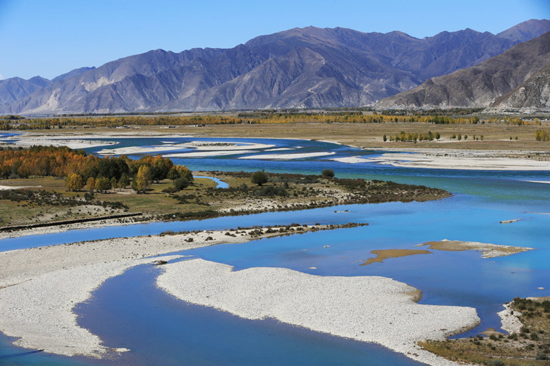
The source region of the Lhasa River is a flat wetland (平坦湿地), located at an elevation of 5,200 meters (海拔5200米). The total elevation drop (落差) from source to mouth is about 1,620 meters (落差1620米), with the southern basin featuring mountains ranging from 4,000 to 4,500 meters (海拔4000~4500米) and valley floors around 3,580 meters (米). The river’s water potential is estimated at 1.717 million kilowatts (水能蕴藏量171.7万千瓦), ranking third among the tributaries of the Yarlung Tsangpo.
Hydrological Characteristics
The Lhasa River (拉萨河) has a total elevation drop of 1,620 meters (米), with an average gradient of 2.9‰. The river can be divided into three sections:
-
Upper Reach (上游段): From the source to the confluence with Sangqu (桑曲), it spans 256 kilometers (公里) with an elevation drop of 960 meters (米) and an average gradient of 3.8‰. This section flows through hilly valleys.
-
Middle Reach (中游段): From the confluence with Sangqu to Zhi Kong (直孔), the section stretches 138 kilometers (公里) with an elevation drop of 360 meters (米) and an average gradient of 2.6‰. The valley gradually widens from 700 meters (米) to 1-2 kilometers (公里) on both sides.
-
Lower Reach (下游段): From Zhi Kong to the Yarlung Tsangpo River (雅鲁藏布江), the stretch is 157 kilometers (公里) long with an elevation drop of approximately 300 meters (米) and an average gradient of 1.9‰. The flow becomes gentler here, with a wide riverbed ranging from 1 to 3 kilometers (公里).
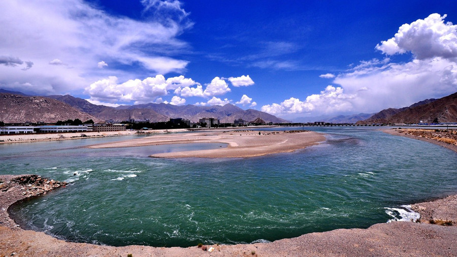
The river flows through wide valleys and the flat basin, especially noticeable near Mozhugongka (墨竹工卡), where the valley width increases to 7.8 kilometers (公里). Lhasa (拉萨) lies along the right bank of the river, where the river supports a population involved in agriculture, industry, and animal husbandry. The river’s basin accounts for only 2.7% of Tibet’s total land area, but it holds about 15% of the region’s population and arable land.
Infrastructure and Development
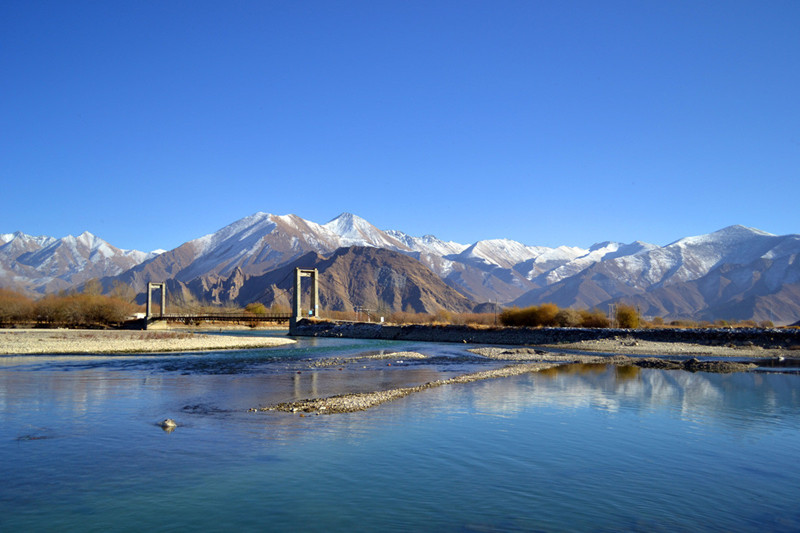
Bridges and Tunnels
-
Lhasa Bridge (拉萨大桥): Built in 1965 (1965年), this was the first bridge over the Lhasa River, spanning 928 meters (米) in length and 7.6 meters (米) in width. Local Tibetans fondly call it “Gu Ru Sang Ba” (估如桑巴).
-
Najin Bridge (纳金大桥), Liuwu Bridge (柳梧大桥), Liudong Bridge (柳东大桥), and Yingqin Bridge (迎亲大桥) are additional bridges that facilitate easy access across the river, improving connectivity.
-
Lhasa River Super Bridge (拉萨河特大桥): This iconic structure on the Qinghai-Tibet Railway (青藏铁路) spans 928.85 meters (米) with the longest span of 108 meters (米). Featuring innovative structural designs and ethnic Tibetan elements, the bridge’s arches resemble a khata (哈达) in the air, offering views of the Potala Palace (布达拉宫) in the distance.
Hydroelectric Development
-
Zhi Kong Hydroelectric Station (直孔水电站): Located at the confluence of the middle and lower reaches of the Lhasa River, about 96 kilometers (公里) from Lhasa (拉萨), this station has a total installed capacity of 100,000 kilowatts (千瓦时), generating an average annual output of 407 million kilowatt-hours (亿千瓦时). The power station serves Lhasa, Shannan, Shigatse (日喀则), and regions along the Qinghai-Tibet Railway (青藏铁路). It provides both flood control and irrigation functions.
Water Conservation and Dams
-
Water Dams (河流拦水坝): To combat desertification, four dams (拦水坝) will be constructed in the Lhasa River’s urban section. These dams will help prevent sand accumulation during the dry season and create larger water surfaces to improve the river’s ecological health.
Ecological and Urban Development
-
Lhasa River Scenic Project (拉萨河景观工程): An ongoing 30-billion-yuan project (30亿元) to improve water quality, prevent desertification, and create a vibrant, sustainable landscape. Once completed, it will attract tourists with activities like boat tours along the river, including the introduction of Tibetan-style wooden boats (藏式木船).
-
Ecological Protection (生态保护): As of April 2023 (2023年4月), Tibet is conducting an ecological protection evaluation (生态保护工程实施成效评估) for the source region (源头) of the Lhasa River to assess environmental impacts and ensure the sustainability of local ecosystems.
Tourist Attractions and Activities
Riverbank Activities
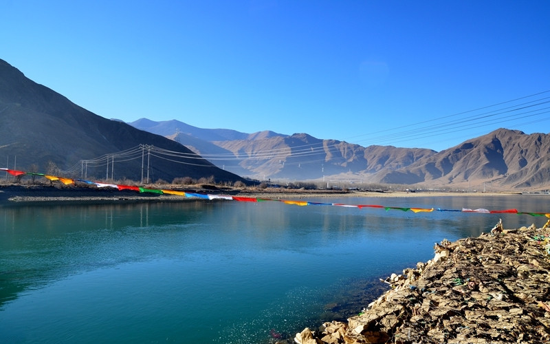
Lhasa locals (拉萨市民) enjoy the river by visiting its banks on weekends and holidays. Many gather to camp, fish, or simply relax by the river, drinking butter tea (酥油茶) and sharing homemade foods. This tradition of riverbank leisure resembles traditional Chinese picnicking (野炊).
The north bank of the river (河北岸) features a wide riverfront plaza (河畔广场) with white railings and benches. It’s a popular spot for couples and families to take leisurely strolls while enjoying the peaceful atmosphere.
Qinghai-Tibet Road Memorial (青藏川藏公路纪念碑)
Located along the Lhasa River, this memorial (纪念碑) was erected on December 25, 1984 (1984年12月25日) to celebrate the 30th anniversary (三十周年) of the opening of the Qinghai-Tibet Highway (青藏公路). The highway remains an essential transport artery for Tibet, even after the completion of the Qinghai-Tibet Railway (青藏铁路).
River Conservation Projects
In June 2022 (2022年6月10日), the Lhasa River’s riverbank management project (拉萨河河势控导工程) was completed, focusing on environmental improvement and enhancing urban landscapes by protecting and improving the city’s water ecosystem.
Transportation Information
-
Walking (徒步): The river’s downtown sections are easily accessible by foot, making it a great location for leisurely walks along the river’s edge.
The Lhasa River (拉萨河) plays a significant role in both the ecological and cultural life of Tibet. From its historical importance to the ongoing infrastructure and tourism projects, the river continues to shape the region’s landscape, economy, and lifestyle. Visitors can enjoy the stunning scenery, cultural landmarks, and water-based activities while witnessing Tibet’s dedication to preserving its natural beauty and cultural heritage.


