Quick Answer: Can You Self-Drive Through Northeast China?
Yes — with a licensed travel agency, a temporary Chinese driving licence, and a guide-escort vehicle accompanying your car. Northeast China self-drive routes cross four provinces and autonomous regions (Liaoning, Jilin, Heilongjiang, and Inner Mongolia), running along three international borders with North Korea, Russia, and Mongolia. Two main itineraries cover the region: a 23-day frontier border drive tracing China's entire eastern edge from Dalian (大连) to Arxan (阿尔山), and a 15-day cross-provinces loop connecting Shenyang (沈阳) through Changbai Mountain (长白山) and Arctic Village (北极村) to Harbin (哈尔滨). June through September is the practical driving window, with September offering the best autumn colours in the Greater Khingan Mountains (大兴安岭).
Key Takeaways
✔ Northeast China is one of the least-touristed self-drive regions in the country, with long stretches of border highway where you may not pass another foreign vehicle all day.
✔ Two route options cover the region: a 23-day frontier expedition reaching China's northernmost mainland point at Ussuri Shoal (乌苏里浅滩), and a 15-day cross-provinces cultural loop adding Yanji's (延吉) Korean heritage and Qiqihar's (齐齐哈尔) red-crowned crane wetlands.
✔ The driving corridor follows the G331 National Border Highway along the Heilongjiang River (黑龙江), one of Asia's most scenic frontier roads, with Russia visible across the water for hundreds of kilometres.
✔ Changbai Mountain's Heaven Lake (天池) — a volcanic crater lake at the China–North Korea border — is visible on only about 50–100 days per year; early morning visits before 9:00 AM give the best odds of clear skies.
✔ A temporary Chinese driving licence, a registered agency, and a licensed guide-escort are mandatory for all foreign drivers. International Driving Permits are not valid in China.
✔ Summer temperatures along the northern frontier can drop to single digits Celsius at night even in July and August — pack layers regardless of season.
✔ Fuel station gaps of 150–200 km (93–124 mi) exist along the Heihe (黑河) to Mohe (漠河) corridor; top up your tank at every opportunity in remote sections.
Why Northeast China Is China's Last Frontier Self-Drive
 Ka line China-Russia Border Road autumn grassland
 Changbai Mountain Heaven Lake volcanic crater
Morning mist lifts off the Heilongjiang River and Russian birch forests materialise on the far bank. A border marker stands alone in knee-high grass. The highway curves north, deeper into the Greater Khingan Mountains, and the next settlement is an hour away.
This is Northeast China — and almost no foreign drivers know it exists.
- Three international borders in one journey. The route traces the Yalu River border with North Korea near Dandong (丹东), follows the Heilongjiang River border with Russia for over 1,000 km (621 mi), and crosses into the Mongolia-adjacent grasslands of Hulunbuir (呼伦贝尔). No other self-drive corridor in China offers this concentration of frontier geography.
- China's northernmost mainland point. The 23-day route reaches Ussuri Shoal (乌苏里浅滩) at latitude 53°33′42″N — the actual northernmost accessible mainland point — before continuing to Arctic Village (北极村) where summer daylight stretches past 10 PM.
- Volcanic landscapes bookend the drive. Changbai Mountain's (长白山) Heaven Lake crater opens the eastern segment; Arxan National Forest Park's (阿尔山国家森林公园) volcanic lakes close the western one. Between them: Wudalianchi's (五大连池) 14-volcano geopark, one of the world's best-preserved volcanic fields.
- An ecological corridor spanning five biomes. The road crosses Liaoning's Bohai Sea coast, Jilin's alpine forests, Heilongjiang's boreal taiga, Inner Mongolia's grassland steppe, and the volcanic forest-steppe transition around Arxan — all connected by driveable highways.
- Genuine remoteness. Long sections of the G331 border highway pass through areas with no mobile signal, no other traffic, and no English signage. This is China's far edge, not its tourist trail.
- Korean, Mongolian, Ewenki, and Russian cultural layers. The Yanbian Korean Autonomous Prefecture (延边朝鲜族自治州) around Yanji features bilingual signage and authentic Korean cuisine. Hulunbuir's Mongolian herding culture, Genhe's (根河) Ewenki reindeer tribe, and Heihe's Russian-influenced border town each add cultural depth that the standard China tourist circuit never reaches.
Northeast China Self-Drive at a Glance
Northeast China Self-Drive at a Glance: 23-Day Frontier vs 15-Day Cross-Provinces
The Liaoning Coastal Corridor — Dalian, Dandong & the Yalu River Border
 Yalu River Grand Canyon of Changbai Mountains
 Dalian coastal harbour self-drive starting point
Salt air mixes with diesel smoke along Dalian's (大连) harbour promenade. Fishing boats creak against wooden piers and seagulls wheel above the Bohai Sea. The coastal city feels nothing like the wilderness ahead — and that contrast is part of the story.
Both routes begin in Liaoning Province, though they enter from different cities. The 23-day route starts in Dalian and drives approximately 300 km (186 mi) northeast along the G15 expressway to Dandong. The 15-day route starts in Shenyang (沈阳), where the Qing Dynasty's original imperial palace and the September 18th History Museum (九一八历史博物馆) anchor a morning of historical immersion before the 240 km (149 mi) drive south to Dandong.
Dandong (丹东) is the emotional centrepiece of this segment. The city sits on the Yalu River (鸭绿江), directly across from North Korea. The Yalu River Broken Bridge (鸭绿江断桥) — a partially destroyed Korean War-era steel span — lets you walk to the midpoint and look into both countries simultaneously. Along the riverfront promenade, fishing activity, illuminated skylines, and the distant silhouette of North Korean towns create a geopolitical landscape unlike anywhere else in China.
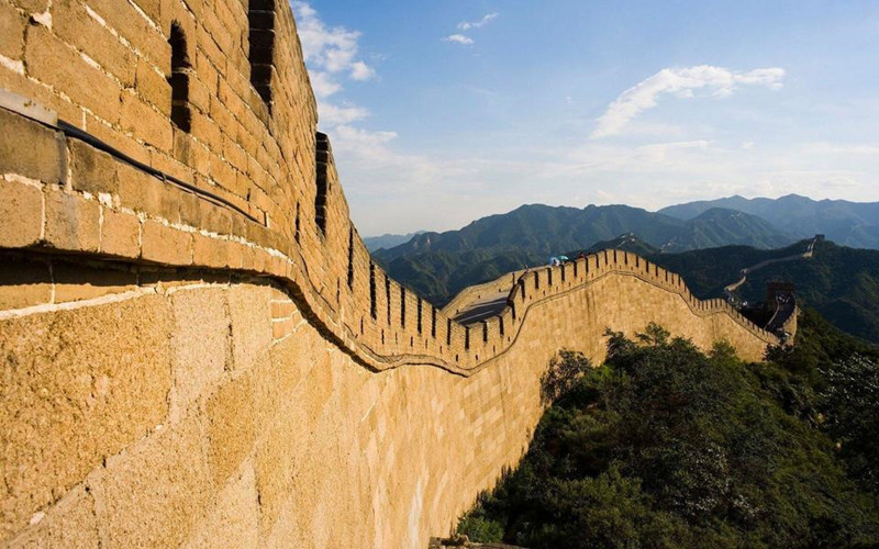
The 15-day route adds Hushan Great Wall (虎山长城) near Dandong — the easternmost section of the Ming Great Wall, rising dramatically above the Yalu River with panoramic views into both countries.
Explore the full self-drive route from Dalian through China's eastern frontier
Tour Route:Dalian-Dandong-Erdao Baihe of Changbai Mountains-Changbai Mountain, Jilin-Jingpo Lake in Ningan City, Mudanjiang-Fuyuan (Jiamusi)-Heixiazi Island in Fuyuan, Jiamusi-Yichun (Heilongjiang)-Harbin-Wudalianchi-Heihe-Beiji Arctic Village in Mohe, Daxing'Anling-Genhe City-Aoluguya Reindeer Village in Genhe City, Hulunbuir-Heishantou Town: Sunset Grassland, Horse Riding & Border Landscape in Ergun City, Hulunbuir-Arxan National Forest Park in Arxan City, Hinggan League-Changchun-Shenyang
Changbai Mountain & Jilin — Heaven Lake, Volcanic Alpine & Korean Culture
 Changbai Mountain Heaven Lake volcanic crater lake
 Self-driving road to Changbai Mountain Reclining Buddha
Cloud shadows race across the volcanic slopes as the shuttle climbs toward the summit. At the top, the wind carries the sound of nothing — and then the mist parts, revealing the impossible blue of Heaven Lake filling a crater the size of a small town.
From Dandong, both routes drive approximately 515–520 km (320–323 mi) inland through eastern Liaoning and southern Jilin to reach Erdaobaihe (二道白河), the gateway town for Changbai Mountain (长白山). The road transitions from river valleys and border plains into increasingly elevated terrain — cooler, greener, and forested.
Changbai Mountain North Slope (长白山北坡) is the highlight. Heaven Lake (天池) sits inside a volcanic caldera at the summit, straddling the China–North Korea border. The lake is visible on roughly 50–100 days per year; morning visits before 9:00 AM offer the best odds before cloud cover builds. Below the summit, Changbai Waterfall (长白瀑布) drops from the crater lake down volcanic cliffs, and the Underground Forest (地下森林) fills a collapsed lava basin with towering trees, thick moss, and air heavy with oxygen.
Where the routes diverge: The 15-day route continues east from Changbai Mountain to Yanji (延吉), capital of the Yanbian Korean Autonomous Prefecture (延边朝鲜族自治州). Here bilingual Korean-Chinese signage lines the streets, and authentic Korean cold noodles (朝鲜冷面), charcoal barbecue (延边烧烤), and stone-pot bibimbap (石锅拌饭) are the evening menu. The 23-day route skips Yanji and heads north through Jingpo Lake (镜泊湖) — one of China's largest volcanic barrier lakes — directly toward the Russia border belt.
The Eastern Heilongjiang Border Belt — Raohe, Fuyuan & Heixiazi Island
 Heixiazi Island border frontier
 Ussuri River scenic border Raohe to Fuyuan
The Ussuri River (乌苏里江) slides past in silence, wide and unhurried. On the far bank, a Russian settlement appears through morning fog — a church steeple, a row of wooden houses, a dirt track disappearing into birch forest. On this side, wetland grasses stretch to the horizon and the road belongs to you alone.
This segment is the 23-day route's defining feature — and the reason travellers choose the longer itinerary. After Jingpo Lake, the road enters the Sanjiang Plain (三江平原) region: 635 km (395 mi) of wetlands, border rivers, and frontier towns ending at Fuyuan (抚远), one of China's easternmost cities.
The Raohe (饶河) to Fuyuan drive along the Ussuri River is one of the most visually striking sections of the entire expedition. The road runs parallel to the river for 222 km (138 mi), with continuous views of the international waterway — Russian settlements visible across calm, winding channels, morning mist rising from wetlands, and wildlife common along the marshes.
Heixiazi Island (黑瞎子岛) — located at the confluence of the Ussuri and Heilongjiang rivers — is a unique border island with viewing platforms, wetland ecosystems, and rare China–Russia boundary geography. The island's tourist area operates daily and requires valid identification for entry.
From Fuyuan, the route drives 620 km (385 mi) west through the Lesser Khingan Mountains (小兴安岭) to Yichun (伊春) — known as the "Forest Capital of China." This is one of the most immersive forest drives in Northeast China: endless pine and birch corridors, river valleys cutting through woodland, and long straight roads that require attention to avoid driving fatigue.
The Northern Frontier — Yichun Forests, Wudalianchi Volcanoes & Heihe Border City
 Wudalianchi volcanic crater lakes Heilongjiang
 Heihe border city Heilongjiang River porter
Black volcanic rock stretches to the treeline under an enormous sky. Crater lakes glint between the cones. The wind carries the mineral tang of thermal springs, and the only other visitors are a handful of Chinese geology students with clipboards.
Both routes converge at Yichun (伊春) before driving through the volcanic heart of northern Heilongjiang.
From Yichun, a 250–280 km (155–174 mi) drive north reaches Wudalianchi Global Geopark (五大连池世界地质公园) — a UNESCO-recognised volcanic landscape containing 14 dormant volcanoes and a network of lava-dammed lakes created by eruptions roughly 300 years ago. The summit of Laoheishan Volcano (老黑山) offers panoramic views across interconnected crater lakes, black lava fields, and volcanic cones. Below, Wenbo Lake (温泊) stays unfrozen year-round due to geothermal activity — an eerie contrast to the surrounding Heilongjiang winter.
Another 230–250 km (143–155 mi) north brings you to Heihe (黑河), a key border city directly facing Russia's Blagoveshchensk across the Heilongjiang River. The riverfront promenade offers wide views of both skylines — especially atmospheric at sunset when both cities illuminate the waterfront. Russian bread, borscht, and smoked sausages appear on local menus alongside standard Northeast Chinese cuisine, reflecting the city's cross-border trade heritage.
The 15-day route adds a stop at Aihui (瑷珲), a historic frontier settlement with an important museum documenting centuries of Sino-Russian border relations and the Treaty of Aigun (瑷珲条约).
Discover the shorter cross-provinces route through the same volcanic corridor
Tour Route:Shenyang-Dandong-Hushan Great Wall in Dandong-Erdao Baihe of Changbai Mountains-Changbai Mountain, Jilin-Yanji City-Jingpo Lake in Ningan City, Mudanjiang-Mudanjiang-Wuying National Forest Park in Yichun (Heilongjiang)-Yichun (Heilongjiang)-Wudalianchi-Heihe-Aihui Ancient Town in Heihe-Mohe City-Beiji Arctic Village in Mohe, Daxing'Anling-Genhe City-Ergun City-Hailar-Zhalong National Nature Reserve in Qiqihar-Qiqihar-Harbin
 15 Days
 21 Places
The "Top of China" Corridor — Huma to Arctic Village
 Arctic Village northernmost settlement
 Greater Khingan Mountains forest corridor
The highway narrows. Larch forests close in on both sides. No phone signal. No other cars. The GPS shows the road curving north for another 200 km (124 mi) before the next dot on the map — and that dot is Arctic Village, China's northernmost settlement.
From Heihe, both routes follow the legendary G331 National Border Highway north along the Heilongjiang River to Huma (呼玛), then deep into the Greater Khingan Mountains (大兴安岭) toward Mohe (漠河) and Arctic Village (北极村).
The Heihe to Huma segment (approximately 230 km / 143 mi) is regarded as one of the most atmospheric border drives in Northeast China. The road parallels the river with continuous views of Russian territory — wetlands, forest belts, fishing settlements, and wide water channels. Luding Mountain (鹿鼎山) offers a forested viewpoint over the Heilongjiang River valley.
Fuel stations become sparse between Heihe and Mohe, with potential gaps of 150–200 km (93–124 mi). Top up at every opportunity. Mobile signal coverage drops to near-zero in deep forest sections of the Greater Khingan Mountains. Download offline maps before entering this corridor, and carry cash — digital payments may not work in remote fuel stops and small settlements.
The Huma to Arctic Village drive (approximately 350–550 km / 217–342 mi depending on stops) passes through one of China's largest continuous forest ecosystems. Dense coniferous forests stretch unbroken to the horizon, punctuated by river valleys, wooden ranger stations, and settlements so small they appear and vanish in the rearview mirror.
Arctic Village (北极村) sits at approximately latitude 53°33′N along the Heilongjiang River, directly facing Russia. During summer, daylight extends past 10 PM and the night sky remains luminous. The village atmosphere is quiet — wooden houses, forest surroundings, and a riverfront walking path.
The actual northernmost accessible mainland point is not Arctic Village itself but Ussuri Shoal (乌苏里浅滩), located at 53°33′42″N — roughly 12″ further north. Both are accessible on the 23-day route. From the shoal's viewing platform, wide riverbanks and sandy wetlands stretch toward the Russian treeline.
Other landmarks near Mohe include the Heilongjiang First Bend (龙江第一湾) — a dramatic Omega-shaped river curve visible from an observation deck — and Nine Bends and Eighteen Turns Wetland (九曲十八弯), a high viewpoint overlooking complex wetland river channels that are especially photogenic in early morning mist.
Arctic Village's main street is lined with "northernmost everything" gift shops — northernmost post office (最北邮局), northernmost bank, northernmost souvenir stand — all charging premium prices for novelty stamps and postcards. These are fine for a quick photo but poor value for money. The real northernmost mainland point is at Ussuri Shoal (乌苏里浅滩), a short drive from the village — do not skip it in favour of the commercial strip.
Greater Khingan Mountains & Inner Mongolia — Genhe, Hulunbuir & Arxan
 Hulunbuir grassland horses grazing
 Arxan National Forest Park volcanic crater lake
The forest ends. Not gradually — abruptly. One moment the road is walled by larch and birch; the next, the steppe opens and the sky doubles in size. Horses graze in grass that rolls to the horizon. The Greater Khingan Mountains are behind you, and Hulunbuir's grasslands stretch ahead, enormous and green.
From Arctic Village, both routes drive south-west into Inner Mongolia through the Greater Khingan Mountains to Genhe (根河) — one of China's coldest cities, historically known as the country's "Cold Pole" (中国冷极) for recording extreme winter temperatures.
Near Genhe, Aoluguya Reindeer Tribe (敖鲁古雅使鹿部落) offers a rare encounter with one of China's last indigenous reindeer-herding communities — the Ewenki (鄂温克族) people. The cultural stop includes close interaction with semi-wild reindeer, traditional forest dwellings, and handicraft traditions.
Where the routes diverge again:
The 23-day route continues west from Genhe through Heishantou (黑山头) — known for its sunset viewpoints over the Hulunbuir Grasslands (呼伦贝尔草原) — past the 186 Colorful Ribbon River (186彩带河) viewpoint, and south to Arxan National Forest Park (阿尔山国家森林公园). Arxan is a volcanic-forest landscape near the China–Mongolia border: crystal-clear crater lakes (including Arxan's own Tianchi 阿尔山天池), lava rock formations in Shitang Forest (石塘林), and the Haraha River (哈拉哈河) winding through forest valleys. The return leg drives through Changchun (长春) and Shenyang.
The 15-day route heads from Genhe through the Ergun Wetland (额尔古纳湿地) — often called Asia's largest and most beautiful wetland — to Hailar (海拉尔), then south to Qiqihar (齐齐哈尔) and the Zhalong National Nature Reserve (扎龙国家级自然保护区). Zhalong covers over 2,000 km² of reed marshes and is one of the world's most important breeding habitats for the endangered red-crowned crane (丹顶鹤). The route ends in Harbin (哈尔滨).
Harbin (哈尔滨) — the cultural capital of Northeast China — features on both routes. Central Street (中央大街) is a historic pedestrian boulevard with European Baroque architecture that feels more like a European city than a Chinese urban centre. Saint Sophia Cathedral (圣索菲亚教堂), with its green onion-shaped dome, is the city's architectural icon. The Chinese Baroque Historic District in Lao Daowai (老道外) combines traditional Chinese courtyards with European decorative facades.
For a desert-and-mountain contrast, our Ningxia–Inner Mongolia desert self-drive covers Helan Mountain and the Alxa Desert Geopark.
Looking for a shorter grassland self-drive closer to Beijing?
Tour Route:Beijing-Xilinhot-Xilingol Grassland-Wulan Butong Grassland Tourist Area in Chifeng-Beijing
7 Days 3 Places View DetailSample Itinerary — 23 Days Along China's Eastern Frontier
23-Day Northeast China Frontier Self-Drive Itinerary
Day 1
Arrive in Dalian
Fly into Dalian (大连), coastal city briefing, seafood dinner, vehicle preparation and self-drive orientation.
Days 2–3
Dalian to Dandong
Coastal expressway drive (300 km), Yalu River border exploration, Broken Bridge, Korean War history sites.
Days 4–5
Dandong to Changbai Mountain
520 km drive through alpine forests; full-day Heaven Lake volcanic crater exploration, waterfall, underground forest.
Days 6–7
Jingpo Lake & Russia Border Belt
Volcanic barrier lake, then Sanjiang Plain wetlands to Raohe along the Ussuri River frontier.
Days 8–9
Fuyuan & Heixiazi Island
Easternmost China exploration, border island visit, then 620 km forest corridor to Yichun through the Lesser Khingan Mountains.
Days 10–11
Harbin & Wudalianchi
City exploration: Central Street, Saint Sophia Cathedral. Then north to 14-volcano geopark, summit crater views.
Days 12–13
Heihe to Huma
Heilongjiang River border drive along G331, Russian skyline views, frontier town atmosphere.
Days 14–15
Arctic Village & Mohe
Greater Khingan Mountains wilderness drive; Ussuri Shoal (northernmost point), Heilongjiang First Bend, Arctic Village.
Days 16–17
Genhe & Hulunbuir Grasslands
Reindeer tribe visit, Cold Pole city, dramatic forest-to-grassland transition, Heishantou sunset.
Days 18–20
Hulunbuir to Arxan
Grassland driving, 186 Ribbon River viewpoint, then volcanic forest park — crater lakes, lava rock, alpine rivers.
Days 21–23
Changchun, Shenyang & Departure
Changchun Film Museum, Jingyuetan forest park, Shenyang Imperial Palace, journey ends.
For travellers with less time, the 15-day cross-provinces route covers many of the same highlights — Dandong, Changbai Mountain, Wudalianchi, the G331 border highway, Arctic Village, Genhe, and Hulunbuir — while adding Yanji's Korean culture and Qiqihar's crane wetlands, ending in Harbin rather than Shenyang.
Tour Route:Shenyang-Dandong-Hushan Great Wall in Dandong-Erdao Baihe of Changbai Mountains-Changbai Mountain, Jilin-Yanji City-Jingpo Lake in Ningan City, Mudanjiang-Mudanjiang-Wuying National Forest Park in Yichun (Heilongjiang)-Yichun (Heilongjiang)-Wudalianchi-Heihe-Aihui Ancient Town in Heihe-Mohe City-Beiji Arctic Village in Mohe, Daxing'Anling-Genhe City-Ergun City-Hailar-Zhalong National Nature Reserve in Qiqihar-Qiqihar-Harbin
15 Days 21 Places View DetailPractical Logistics — When to Go, What to Drive, What to Know
Best Time for a Northeast China Self-Drive
Afternoon sun warms the Hulunbuir steppe and the thermometer reads 24°C (75°F). Three months from now, the same spot will be buried under snow at −30°C (−22°F). Timing matters more here than in any other self-drive region in China.
Northeast China Self-Drive Season Guide
For a detailed month-by-month regional breakdown, see our complete guide to self-drive timing across China.
Permits & Documentation
All foreign drivers in China must hold:
- A temporary Chinese driving licence (临时机动车驾驶许可) — International Driving Permits are not recognised. See our step-by-step licence guide for the full process.
- A licensed guide-escort travelling with your convoy — this is a legal requirement, not optional. Read why China requires a guide-escort for all foreign drivers to understand the regulation.
- Valid passport and Chinese visa
- Vehicle registration and insurance documents (handled by Yaso Trip for agency-arranged vehicles)
Border-zone note: Photography near military installations and border fences along the Heilongjiang River is restricted. Your guide-escort will brief you on specific locations where cameras must remain stowed.
How to Get to Northeast China
Getting to Northeast China
What to Pack
- Warm layers even in summer — northern Heilongjiang drops to 5–10°C (41–50°F) at night in July and August
- Rain gear and waterproof hiking shoes (Changbai Mountain, Greater Khingan forests)
- Sunscreen, sunglasses, and hat (grassland UV is strong)
- Cash in small denominations (¥10–¥50 notes) — digital payments fail in some remote fuel stops
- Offline navigation maps (Baidu Maps or Amap — Google Maps does not function in China)
- Power bank and car charger
- Personal medications — pharmacies are scarce between Heihe and Mohe
Tips, Cautions & What to Watch Out For
Winter self-driving in northern Heilongjiang means temperatures of −30°C to −40°C (−22°F to −40°F), black ice on the G331, reduced daylight hours, and limited roadside assistance. Mohe and Genhe regularly record the lowest temperatures in China. Winter expeditions require specialised cold-weather vehicles, tyre chains, engine block heaters, and emergency cold-survival kits. This is not a route for first-time winter drivers.
Many sections of the Heilongjiang River border corridor pass through restricted military and border-security zones. Drones are prohibited in most riverside areas near Dandong, Heihe, and Mohe. Your guide-escort will identify specific locations where photography is restricted — follow their instructions to avoid delays at checkpoints.
- Top up fuel at every station in remote segments. The longest potential gaps are between Heihe and Mohe along the G331, where stretches of 150–200 km (93–124 mi) may have only one fuel station.
- Wildlife crossings are common in forest sections, especially at dawn and dusk. Deer, small mammals, and occasionally larger animals cross the highway in the Lesser and Greater Khingan Mountains. Reduce speed in shaded forest curves.
- Carry identification at all times. Multiple border checkpoints operate along the G331 and near Dandong, Heihe, and Mohe. Your guide-escort will handle communication, but having your passport accessible speeds the process.
- Avoid driving after dark on forest highways. Fog, wildlife, and narrow roads with no lighting make night driving unnecessarily risky in the Greater Khingan Mountains.
- Download offline maps before entering remote areas. Mobile coverage drops to zero in deep forest sections between Huma and Mohe, and between Mohe and Genhe.
- Pace yourself on long driving days. Several segments exceed 500 km (311 mi). The 23-day route includes a 635 km (395 mi) day from Jingpo Lake to Raohe. Schedule rest stops every 2–3 hours; the guide-escort vehicle carries emergency supplies.
- Northeast cuisine is hearty but limited in variety in remote areas. Expect dumplings (饺子), stews (炖菜), and river fish in small frontier towns. Vegetarian options are scarce outside major cities.
Why Travel Northeast China With Yaso Trip
 Yaso China Self-Driving Grand Tour
 Yaso Trip self-driving vehicles Tank 300
- Border-zone logistics handled end-to-end. The Heilongjiang River corridor requires awareness of border regulations, checkpoint procedures, and photography restrictions that change seasonally. Yaso Trip's guide-escort team manages all checkpoint interactions and route-specific compliance so you focus on driving.
- Remote-area fuel and vehicle planning. With fuel gaps of up to 200 km (124 mi) on the northern corridor, Yaso Trip pre-maps every fuel stop and carries reserve supplies in the escort vehicle. Satellite communication equipment covers the mobile dead zones between Huma and Mohe.
- Temporary licence and permit processing. The entire paperwork chain — temporary Chinese driving licence, temporary plates, insurance, border-area travel notifications — is handled before you arrive. No airport paperwork scramble.
- Local knowledge of seasonal conditions. Road closures, weather windows, and attraction access rules shift year to year across this vast region. Yaso Trip's team updates route intelligence seasonally, especially for the northern Heilongjiang corridor and Changbai Mountain summit access.
Start Planning Your Northeast China Self-Drive
Northeast China is the self-drive frontier that the guidebooks haven't caught up with yet. Three international borders, volcanic landscapes from Changbai to Arxan, the northernmost point of mainland China, and hundreds of kilometres of empty highway along the Heilongjiang River — all connected by driveable roads and supported by Yaso Trip's local team.
Whether you choose the full 23-day frontier expedition or the 15-day cross-provinces cultural loop, the result is the same: a driving experience that most visitors to China never know exists.
For a route plan customised to your dates, group size, and driving preferences, contact the Yaso Trip team for a custom quote.


 View All China Tours



 View All China Theme Tours by Interest


 Home


