G331 National Highway, officially known as the Dandong–Altay Highway (丹东—阿勒泰公路), is one of the most remarkable long-distance self-drive routes in China. Running for about 9,333 kilometers, it starts from Dandong (丹东) on the Yalu River in Liaoning and ends at Aheituobieke Port (阿黑吐拜克口岸) in Habahe County (哈巴河县), Xinjiang. Closely following China’s northern frontier, the route connects the borders of North Korea, Russia, and Mongolia, crossing Liaoning, Jilin, Heilongjiang, Inner Mongolia, Gansu, and Xinjiang. Known among road travelers as the “King of China’s Northern Border Roads,” G331 National Highway combines border culture, ethnic villages, volcanic mountains, primeval forests, wetlands, grasslands, Gobi deserts, glaciers, and remote frontier ports into one epic overland journey.
Overview of G331 National Highway
Essential Facts
| Item |
Details |
| Official Name |
Dandong–Altay National Highway / G331 |
| Total Distance |
About 9,333 km |
| Starting Point |
Dandong, Liaoning |
| Ending Point |
Aheituobieke Port, Habahe County, Xinjiang |
| Provinces and Regions |
Liaoning, Jilin, Heilongjiang, Inner Mongolia, Gansu, Xinjiang |
| Border Countries |
North Korea, Russia, Mongolia |
| Road Character |
Mostly paved asphalt highway with scenic border-road sections |
| Travel Style |
Long-distance self-drive, borderland travel, photography, cultural exploration |
The route is more than a national road; it is a complete northern China travel corridor. From the Yalu River valley to Changbai Mountain (长白山), from the Amur River (黑龙江) to the Greater Khingan Range (大兴安岭), from Hulunbuir Grassland (呼伦贝尔草原) to the Altai Mountains (阿尔泰山), the scenery changes constantly. Most sections are suitable for normal cars in spring, summer, and autumn, while winter driving requires stronger vehicles, snow tires, and serious preparation.
Main Route Sections
| Section |
Route |
| Liaoning |
Dandong – Kuandian – Jilin Border |
| Jilin |
Ji’an – Linjiang – Changbai – Fusong – Yanji – Tumen – Hunchun |
| Heilongjiang |
Dongning – Suifenhe – Fuyuan – Tongjiang – Heihe – Mohe |
| Inner Mongolia |
Shiwei – Erguna – Manzhouli – Arxan – Xilingol – Erenhot – Ejina |
| Gansu |
Mazongshan Gobi Transit Section |
| Xinjiang |
Hami – Barkol – Qinghe – Fuyun – Altay – Habahe |
Liaoning Section: Along the Yalu River Border
Major Destinations
The Liaoning section begins in Dandong, one of China’s most famous border cities. Facing North Korea across the Yalu River, Dandong is a gentle and highly accessible starting point for travelers who want to begin the G331 self-drive route with history, river scenery, and easy road conditions. The road then continues through Kuandian Manchu Autonomous County (宽甸满族自治县), where mountain valleys, riverside villages, and border landscapes create a relaxed introduction to the journey.
Top Attractions
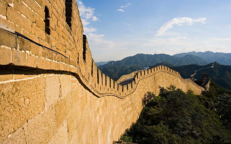
Yalu River Broken Bridge (鸭绿江断桥) is the symbolic landmark of Dandong, offering close views of the river and the opposite bank. Hushan Great Wall (虎山长城) is known as the eastern starting point of the Ming Great Wall and is ideal for travelers interested in frontier history. Memorial Hall of the War to Resist US Aggression and Aid Korea (抗美援朝纪念馆) provides important historical context for the city. Along the Kuandian section, Green River Village (绿江村) is famous for misty river views, farming scenery, and peaceful valleys, while Hunjiang Grand Bend Viewpoint (浑江大转弯) offers one of the most impressive river-bend panoramas on the eastern part of G331. Hekou Scenic Area (河口景区) is especially attractive in spring when peach blossoms bloom along the riverbanks.
This section is suitable for beginners, families, photography lovers, and travelers who prefer shorter driving distances. Roads are generally smooth, villages are frequent, and food and accommodation are easy to find. The landscapes are soft and scenic, with river valleys, wooded hills, border bridges, and quiet rural views forming the main travel experience.
Jilin Section: The Most Scenic Part of G331
Major Destinations
The Jilin section passes through Ji’an (集安), Linjiang (临江), Changbai Korean Autonomous County (长白朝鲜族自治县), Fusong County (抚松县), Yanji (延吉), Tumen (图们), and Hunchun (珲春). This is one of the most rewarding parts of G331 National Highway, with excellent road conditions, dense scenic resources, and a strong mix of mountain landscapes and Korean ethnic culture.
Highlights of Ji’an
Ancient Koguryo Kingdom Ruins (高句丽王城) and Stele of King Gwanggaeto (好太王碑) are key cultural sites for understanding the ancient history of the region. Yalu River Border Railway Bridge (鸭绿江国境铁路大桥) brings travelers close to the frontier atmosphere, while Wunvfeng National Forest Park (五女峰国家森林公园) offers forest hiking, cliffs, valleys, and seasonal foliage. Ji’an is also a good overnight stop because it combines history, riverside scenery, and convenient city facilities.
Highlights of Changbai Region
The Changbai area is one of the visual highlights of the route. Heaven Lake South Slope of Changbai Mountain (长白山天池南坡) offers a quieter approach to the volcanic lake compared with more crowded entrances. Wangtiane Goose Canyon (望天鹅峡谷) is known for basalt cliffs, waterfalls, deep valleys, and colorful autumn forests. The road between Linjiang and Changbai follows the Yalu River for long stretches, with mountain curves, border villages, and wide river views.
Highlights of Yanji and Hunchun
Yanji is the cultural center of the Korean ethnic community in Jilin, known for Korean-style food, markets, folk villages, and lively night streets. Tumen River Port (图们江口岸) gives visitors a close view of border life along the Tumen River. Hunchun is famous for Fangchuan Scenic Area (防川景区), where travelers can look toward China, Russia, and North Korea from one viewpoint. Longhu Pavilion (龙虎阁) is the classic viewing platform for this “one view, three countries” experience.
This section is highly recommended for spring, summer, and autumn. Spring brings mountain flowers, summer offers cool forest weather, and autumn creates some of the best foliage scenery in Northeast China. Travelers should allow enough time here instead of rushing through, because the scenic spots are close together and each county has its own character.
Heilongjiang Section: From China’s Easternmost Point to Its Northernmost Point
Major Destinations
The Heilongjiang section covers Dongning (东宁), Suifenhe (绥芬河), Muling (穆棱), Jixi (鸡西), Fuyuan (抚远), Tongjiang (同江), Jiayin (嘉荫), Heihe (黑河), Tahe (塔河), and Mohe (漠河). This part of G331 is vast, remote, and deeply atmospheric, with forests, wetlands, rivers, frontier towns, and strong China–Russia border features.
Easternmost China: Fuyuan
Fuyuan is known as China’s easternmost city. Eastern Pole Square (东极广场) is a classic sunrise destination where travelers can watch the first rays of sunlight in China. Heixiazi Island (黑瞎子岛) combines wetland scenery, border geography, and wildlife habitats. The Ussuri River (乌苏里江) sunrise is especially beautiful in summer and autumn, while local Hezhe ethnic fishing villages offer cultural experiences related to river life, fish cuisine, and traditional customs.
Heihe Border Region
Heihe faces Russia across the Amur River and is one of the most distinctive border cities on the route. Aihui Historical Museum (瑷珲历史陈列馆) helps visitors understand the region’s frontier history, while river cruises provide broad views of the China–Russia border. The city has a relaxed riverside atmosphere, Russian-style elements, and convenient facilities, making it a practical rest point before continuing toward the Greater Khingan forests.
Mohe: China’s Arctic Town
Mohe is the northernmost travel destination in China and one of the most iconic stops on G331 National Highway. Arctic Village (北极村) is famous for “finding north,” winter snow scenes, and summer solstice light. First Bay of Heilongjiang River (龙江第一湾) provides a dramatic river-bend view surrounded by forested mountains. Jiuqu Shibawan Wetland (九曲十八弯) is best visited at sunrise or sunset, while Christmas Village (圣诞村) and northern lights observation areas add a unique Arctic-style travel experience.
This section requires more careful planning than Liaoning and Jilin. Distances between towns are longer, forest roads may have fewer services, and weather changes quickly. In summer, wetlands and forests are green and refreshing; in autumn, the Greater Khingan Range turns golden; in winter, Mohe becomes one of China’s most famous ice-and-snow destinations.
Inner Mongolia Section: Grasslands, Wetlands and Desert Frontiers
Major Destinations
The Inner Mongolia section includes Shiwei (室韦), Enhe (恩和), Erguna (额尔古纳), Manzhouli (满洲里), Arxan (阿尔山), Xilinhot (锡林浩特), Erenhot (二连浩特), and Ejina Banner (额济纳旗). This is the longest and most open section of G331, with dramatic changes from forest grassland to volcanic landscapes, steppe, Gobi, and desert oasis.
Hulunbuir Region
The Hulunbuir section is one of the best summer self-drive areas in China. Shiwei and Enhe are known for Russian ethnic villages, wooden houses, river scenery, and quiet countryside views. Erguna Wetland (额尔古纳湿地) is often described as one of the finest wetlands in Asia, with winding rivers, grasslands, forests, and sunset viewpoints. Manzhouli National Gate (满洲里国门) and Matryoshka Square show the city’s China–Russia border character, with colorful architecture and lively night views.
Arxan Region
Arxan National Forest Park (阿尔山国家森林公园) features volcanic landforms, crater lakes, mineral springs, lava landscapes, forests, and the famous unfrozen river scenery. The area is cool in summer, colorful in autumn, and snowy in winter. It is one of the most photogenic stops in Inner Mongolia, but weather can be unpredictable, and mountain roads may be closed during heavy snow.
Ejina Region
Ejina Poplar Forest (胡杨林) is the most famous autumn attraction in western Inner Mongolia. The golden poplar season is short but spectacular, usually attracting photographers from across China. Black City Ruins (黑城遗址) and Juyan Lake (居延海) add desert history, oasis scenery, and sunrise photography opportunities. This area is much drier and more remote than eastern Inner Mongolia, so fuel, water, and accommodation should be planned carefully.
This section offers the widest landscape contrast on G331. Travelers can experience Russian-style villages, Mongolian grasslands, volcanic forests, border gates, dinosaur fossil culture, Gobi highways, and desert poplar forests in one long journey.
Gansu Section: Mazongshan Gobi Crossing
The Gansu section of G331 around Mazongshan (马鬃山) is a short but highly remote desert transition area. There are few large towns, limited fuel stations, and very basic services. It is not usually treated as a sightseeing destination, but rather as a necessary link between Inner Mongolia and Xinjiang. Travelers should fill the fuel tank before entering, carry drinking water and emergency food, and avoid night driving because visibility, rescue access, and mobile signal coverage can be limited.
Xinjiang Section: The Grand Finale of G331
Major Destinations
The Xinjiang section passes through Hami (哈密), Barkol Kazakh Autonomous County (巴里坤哈萨克自治县), Qinghe County (青河县), Fuyun County (富蕴县), Altay City (阿勒泰市), and Habahe County. This final section brings travelers into a world of snow mountains, alpine lakes, Kazakh pastures, mining history, birch forests, and border villages.
Must-Visit Attractions
Barkol Region
Barkol Grassland (巴里坤草原) is a highland pasture area with open views, grazing animals, and Kazakh cultural elements. Barkol Lake (巴里坤湖) is especially atmospheric at sunrise and sunset, with reflections, wetlands, and distant mountains. Kazakh villages around the region give travelers a chance to experience traditional food, yurts, music, and pastoral life.
Fuyun Region
Keketuohai National Geopark (可可托海) is one of the most important scenic areas in northern Xinjiang. It combines the Irtysh Grand Canyon (额尔齐斯大峡谷), granite peaks, forests, rivers, and mining heritage. The No.3 Mine Pit is known for its historical importance, while the canyon area is excellent for hiking, photography, and autumn foliage. The road toward Fuyun is particularly beautiful in September when birch trees begin to turn yellow.
Altay Region
Altay City is a comfortable base for exploring northern Xinjiang. General Mountain, the Kelan River, and Birch Forest Park create a relaxed alpine-town atmosphere. The area is suitable for travelers who want to slow down before reaching the final border section. In winter, Altay is also known for snow sports and deep powder snow.
Habahe Region
White Sand Lake (白沙湖) is a quiet desert-lake landscape surrounded by dunes, reeds, and frontier scenery. Baihaba Village (白哈巴村) is often called one of China’s most beautiful border villages, with wooden houses, golden birch forests, snow mountains, and Kazakh-Tuva cultural atmosphere. Aheituobieke Port marks the western terminus of G331 and is a meaningful final photo stop for travelers completing the route.
The Xinjiang section feels remote, spacious, and highly scenic. It is best explored in summer and autumn, especially from June to September. Winter travel is possible only for experienced drivers with proper vehicles and updated road information.
G331 Dandong → No.185 Regiment Aheitubieke Port Full 47-Day Self-Drive Itinerary
Phase 1: Liaoning Section (Day 1–Day 3)
D1 | Dandong City (丹东市) – Hushan Town (虎山镇) – Changdian Town (长甸镇) | 210 km | Kuandian County (宽甸县城)
D2 | Kuandian County (宽甸县城) – Zhenjiang Town (振江镇) – Xialuhe Korean Ethnic Township (下露河朝鲜族乡) | 230 km | Xialuhe Township (下露河乡)
D3 | Xialuhe Township (下露河朝鲜族乡) – Ji’an City (集安市) | 190 km | Ji’an City (集安市)
Phase 2: Jilin Section (Day 4–Day 11)
D4 | Ji’an City (集安市) | 0 km | Ji’an City (集安市)
D5 | Ji’an City (集安市) – Qingshi Town (青石镇) – Linjiang City (临江市) | 220 km | Linjiang City (临江市)
D6 | Linjiang City (临江市) – Changbai County (长白县) | 195 km | Changbai County (长白县)
D7 | Changbai County (长白县) – Erdaobaihe Town (二道白河镇) | 240 km | Erdaobaihe Town (二道白河镇)
D8 | Erdaobaihe Town (二道白河镇) | 0 km | Erdaobaihe Town (二道白河镇)
D9 | Erdaobaihe Town (二道白河镇) – Longjing City (龙井市) | 260 km | Longjing City (龙井市)
D10 | Longjing City (龙井市) – Tumen City (图们市) | 110 km | Tumen City (图们市)
D11 | Tumen City (图们市) – Hunchun City (珲春市) | 130 km | Hunchun City (珲春市)
Phase 3: Heilongjiang East Section (Day 12–Day 23)
D12 | Hunchun City (珲春市) – Dongning City (东宁市) | 290 km | Dongning City (东宁市)
D13 | Dongning City (东宁市) – Suifenhe City (绥芬河市) – Muling City (穆棱市) | 270 km | Muling City (穆棱市)
D14 | Muling City (穆棱市) – Jidong County (鸡东县) | 240 km | Jidong County (鸡东县)
D15 | Jidong County (鸡东县) – Mishan City (密山市) | 210 km | Mishan City (密山市)
D16 | Mishan City (密山市) – Hulin City (虎林市) | 200 km | Hulin City (虎林市)
D17 | Hulin City (虎林市) – Raohe County (饶河县) | 220 km | Raohe County (饶河县)
D18 | Raohe County (饶河县) – Fuyuan City (抚远市) | 330 km | Fuyuan City (抚远市)
D19 | Fuyuan City (抚远市) | 0 km | Fuyuan City (抚远市)
D20 | Fuyuan City (抚远市) – Suibin County (绥滨县) | 260 km | Suibin County (绥滨县)
D21 | Suibin County (绥滨县) – Jiayin County (嘉荫县) | 310 km | Jiayin County (嘉荫县)
D22 | Jiayin County (嘉荫县) – Sunwu County (孙吴县) | 280 km | Sunwu County (孙吴县)
D23 | Sunwu County (孙吴县) – Heihe City (黑河市) | 210 km | Heihe City (黑河市)
Phase 4: Greater Khingan Section (Day 24–Day 28)
D24 | Heihe City (黑河市) – Huma County (呼玛县) | 340 km | Huma County (呼玛县)
D25 | Huma County (呼玛县) – Tahe County (塔河县) | 320 km | Tahe County (塔河县)
D26 | Tahe County (塔河县) – Mohe City (漠河市) | 300 km | Mohe City (漠河市)
D27 | Mohe City (漠河市) | 0 km | Mohe City (漠河市)
D28 | Mohe City (漠河市) – Enhehada (恩和哈达) | 360 km | Enhehada (恩和哈达)
Phase 5: Inner Mongolia Grassland (Day 29–Day 33)
D29 | Enhehada (恩和哈达) – Shiwei Town (室韦镇) | 350 km | Shiwei Town (室韦镇)
D30 | Shiwei Town (室韦镇) – Heishantou Town (黑山头镇) | 210 km | Heishantou Town (黑山头镇)
D31 | Heishantou Town (黑山头镇) – Manzhouli City (满洲里市) | 200 km | Manzhouli City (满洲里市)
D32 | Manzhouli City (满洲里市) – New Barag Right Banner (新巴尔虎右旗) | 240 km | New Barag Right Banner (新巴尔虎右旗)
D33 | New Barag Left Banner (新巴尔虎左旗) – Arxan City (阿尔山市) | 370 km | Arxan City (阿尔山市)
Phase 6: Inner Mongolia Plateau (Day 34–Day 39)
D34 | Arxan City (阿尔山市) – East Ujimqin Banner (东乌珠穆沁旗) | 360 km | East Ujimqin Banner (东乌珠穆沁旗)
D35 | East Ujimqin Banner (东乌珠穆沁旗) – Xilinhot City (锡林浩特市) | 280 km | Xilinhot City (锡林浩特市)
D36 | Xilinhot City (锡林浩特市) – Erenhot City (二连浩特市) | 390 km | Erenhot City (二连浩特市)
D37 | Erenhot City (二连浩特市) – Damao Banner (达茂旗) | 370 km | Damao Banner (达茂旗)
D38 | Damao Banner (达茂旗) – Alxa Left Banner (阿拉善左旗) | 380 km | Alxa Left Banner (阿拉善左旗)
D39 | Alxa Left Banner (阿拉善左旗) – Ejin Banner (额济纳旗) | 360 km | Ejin Banner (额济纳旗)
Phase 7: Gansu–Xinjiang Transition (Day 40–Day 41)
D40 | Ejin Banner (额济纳旗) – Mazongshan (马鬃山) | 340 km | Mazongshan (马鬃山)
D41 | Mazongshan (马鬃山) – Hami (哈密市) | 380 km | Hami (哈密市)
Phase 8: Xinjiang Final Section (Day 42–Day 47)
D42 | Hami (哈密市) – Santanghu (三塘湖镇) | 320 km | Santanghu (三塘湖镇)
D43 | Santanghu (三塘湖镇) – Mulei (木垒县) | 290 km | Mulei (木垒县)
D44 | Mulei (木垒县) – Fuyun (富蕴县) | 370 km | Fuyun (富蕴县)
D45 | Fuyun (富蕴县) – Altay (阿勒泰市) | 240 km | Altay (阿勒泰市)
D46 | Altay (阿勒泰市) – Burqin (布尔津县) | 180 km | Burqin (布尔津县)
D47 | Burqin (布尔津县) – No.185 Regiment Aheitubieke Port (185团阿黑吐别克口岸) | 220 km | 185 Regiment (185团)
Best Time to Drive G331
Spring (April–May)
Spring is suitable for shorter sections in Liaoning, Jilin, and parts of northern Xinjiang. The Yalu River valley becomes attractive when peach blossoms bloom around Hekou, while Green River Village often has misty water views and soft rural scenery. In the Changbai Mountain region, wildflowers and rhododendrons begin to appear as snow melts. In Xinjiang, Keketuohai and Barkol offer snowmelt streams, early green grasslands, and clear mountain air. However, high-altitude roads around Changbai Mountain and Arxan may still have ice in shaded areas, while Inner Mongolia and Xinjiang desert sections can experience strong sandstorms. Mohe is not recommended in early spring because road ice may remain.
Summer (June–August)
Summer is the best season for a complete G331 self-drive tour. Most sections are open, road conditions are stable, and temperatures are comfortable across Northeast China, Hulunbuir, Arxan, Altay, and Keketuohai. Forests are green, wetlands are full of life, grasslands are at their most beautiful, and highland lakes are clear. Fuyuan is popular for watching China’s earliest sunrise, Yanji and Hunchun are excellent for Korean ethnic culture, Manzhouli offers Russian-style night views, and Altay brings alpine scenery and cool weather. The only sections requiring caution are the Gobi and desert areas around Ejina, Mazongshan, and Hami, where midday heat can be intense. Driving in those areas is better arranged in the morning or late afternoon.
Autumn (September–October)
Autumn is the top photography season along G331. Liaoning and Jilin enter their colorful forest period from mid-September to early October, while the Greater Khingan Range in Heilongjiang becomes golden in September. Ejina’s poplar forest usually reaches its best viewing window in October, making it one of the most sought-after autumn destinations in China. In Xinjiang, Altay and Baihaba show snow mountains, birch forests, wooden houses, and golden pastures in one frame. September road conditions are usually excellent, but by late October, Changbai Mountain, Arxan, Mohe, and high-altitude parts of Xinjiang may begin to receive snow, so travelers should prepare tire chains and winter clothing.
Winter (November–March)
Winter is only suitable for selected short sections rather than the entire 9,333-kilometer route. Dandong, Yanji, Changbai Mountain, and Mohe can be excellent for travelers interested in rime ice, skiing, frozen rivers, snow villages, and Arctic-style landscapes. Mohe is especially popular from December to February for Arctic Village, winter night skies, and possible northern lights. However, Inner Mongolia’s Gobi areas, Mazongshan, Hami, Barkol, and many high-altitude mountain roads can be dangerous or temporarily closed. Winter driving requires four-wheel drive, snow tires, tire chains, anti-freeze equipment, emergency supplies, and preferably at least two vehicles traveling together.
Border Travel Requirements and Driving Tips
Border Pass Requirements
Some controlled frontier areas along G331 require a border permit, including Arctic Village, Shiwei, Baihaba Village, Heixiazi Island, Altay border areas, and certain port zones. Travelers should prepare personal identification documents, driving license, vehicle registration, and border permits before entering sensitive areas. For international travelers, passport and valid China visa documents should be carried at all times. Border checkpoints are common along the route, and all passengers should keep documents easily accessible.
Fuel Strategy
Fuel planning is one of the most important rules on G331 National Highway. Liaoning and Jilin have frequent towns and fuel stations, usually with no major pressure. In Heilongjiang forest regions, especially between Jiayin, Luobei, Tahe, and Mohe, fuel stations can be far apart, so refueling at half tank is recommended. In Inner Mongolia, Gansu, and Xinjiang desert sections, stations may be separated by long distances, and some small towns may only offer basic gasoline types. In winter, small stations in northern areas may operate only during daytime, so travelers should never wait until the fuel warning light appears.
Vehicle Recommendations
For spring, summer, and autumn, most paved sections of G331 can be driven by sedans, MPVs, and urban SUVs. For the complete route, an SUV is more practical because it offers better ground clearance, storage space, and comfort for long-distance travel. In winter or late autumn mountain areas, four-wheel drive, snow tires, and tire chains are strongly recommended. Electric vehicles are not suitable for remote Inner Mongolia, Gansu, and Xinjiang sections because charging stations are limited outside major towns.
Recommended G331 Self-Drive Itineraries
7-Day Beginner Route: Dandong to Changbai Mountain
Dandong → Green River Village → Ji’an → Linjiang → Changbai Mountain → Yanji → Hunchun. This route is ideal for travelers who want a manageable introduction to G331 border road travel. It includes the Yalu River, river-bend viewpoints, Koguryo heritage, Changbai Mountain scenery, Korean ethnic culture, and the famous “one view of three countries” in Hunchun. Roads are generally smooth, distances are reasonable, and food, fuel, and accommodation are easy to arrange.
15-Day Northeast China Border Route
Dandong → Ji’an → Changbai Mountain → Yanji → Fuyuan → Tongjiang → Heihe → Tahe → Mohe. This itinerary focuses on Northeast China’s border rivers, forests, wetlands, and extreme geographic landmarks. Travelers can visit China’s easternmost sunrise point in Fuyuan and the northernmost travel destination in Mohe within one journey. It is suitable for travelers who enjoy forests, rivers, frontier towns, ethnic culture, and cool summer weather or dramatic winter scenery.
30-Day Ultimate G331 Expedition
Manzhouli → Arxan → Xilingol → Ejina → Hami → Barkol → Keketuohai → Altay → Habahe. This long route is designed for experienced drivers, photographers, and travelers seeking the grand landscapes of northern China. It covers Hulunbuir grasslands, Russian-style border cities, volcanic forests, Mongolian steppe, Gobi highways, golden poplar forests, Xinjiang pastures, alpine lakes, and the final G331 endpoint in Habahe. Fuel, hotel, vehicle condition, and route timing should be planned carefully, especially across desert and mountain sections.
Seasonal Quick Reference Guide
| Season |
Best Areas |
Main Highlights |
Essential Gear |
| Spring |
Liaoning, Jilin, Northern Xinjiang |
Peach blossoms, mountain flowers, snowmelt rivers, early grasslands |
Windproof jacket, light down jacket, anti-slip tires |
| Summer |
Entire Route |
Forests, wetlands, grasslands, lakes, border towns, sunrise views |
Sunscreen, insect repellent, light jacket, drinking water |
| Autumn |
Jilin, Heilongjiang, Ejina, Altay |
Colorful forests, golden poplars, birch trees, snow mountains |
Layered clothing, tire chains, warm jacket |
| Winter |
Dandong, Yanji, Changbai Mountain, Mohe |
Rime ice, frozen rivers, snow scenery, Arctic Village |
Snow tires, tire chains, winter gear, emergency tools |
For travelers searching for the most complete China border road trip, G331 National Highway offers one of the richest self-drive experiences in Asia. It is not just a road from Dandong to Altay, but a long journey through northern China’s border history, ethnic cultures, wilderness landscapes, seasonal colors, frontier cities, and remote mountain regions. Whether planned as a 7-day short escape, a 15-day Northeast China route, or a 30-day expedition across grasslands and deserts, G331 remains one of the most unforgettable self-drive adventures in China.